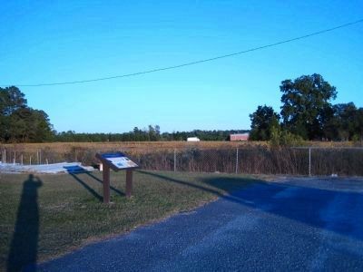
Near Kinston in Lenoir County, North Carolina — The American South (South Atlantic)
Confederate Headquarters
Bragg's Command Post
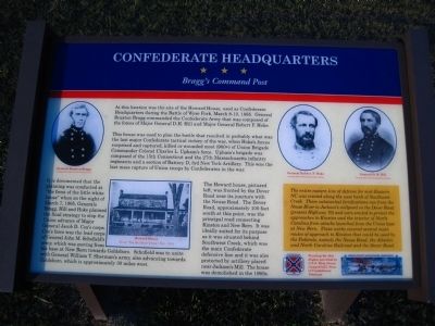
This house was used to plan the battle that resulted in probably what was the last major Confederate tactical victory of the war, when Hoke’s forces surprised and captured, killed or wounded most (900+0 of Union Brigade Commander Colonel Charles L. Upham’s force. Upham’s brigade was composed of the 15th Connecticut and the 27th Massachusetts infantry regiments and a section of Battery D, 3rd New York Artillery. This was the last mass capture of Union troops by Confederates in the war.
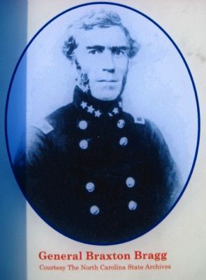
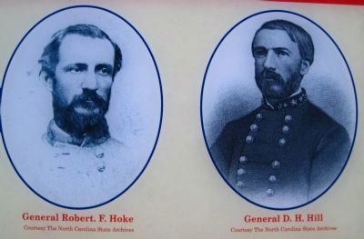
It is documented that the planning was conducted at “the front of the little white house” when on the night of March 7, 1865, Generals Bragg, Hill and Hoke planned the final strategy to stop the Union advance of Major General Jacob D. Cox’s corps. Cox’s force was the lead corps of General John M. Schofield’s army, which was moving from his base at New Bern towards Goldsboro. Schofield was to unite with General William T. Sherman’s army, also advancing towards Goldsboro, which is approximately 30 miles west.
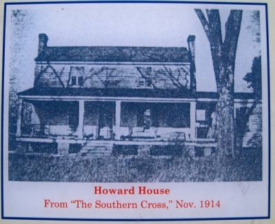
The Howard house, pictured left, was fronted by the Dover Road near its juncture with the Neuse Road. The Dover Road, approximately 100 feet south at this point, was the principal road connecting Kinston and New Bern. It was ideally suited for its purpose as it was situated behind Southwest Creek, which was the main Confederate defensive line and it was also protected by artillery placed near Jackson’s Mill. The house was demolished in the 1960s.
The yellow sidebar on the lower right reads:
The entire eastern line of defense for mid-Eastern NC was erected along the west bank of Southwest Creek. These substantial fortifications ran from the Neuse River to Jackson’s millpond on the Dover Road (present Highway 70) and were erected to protect the approaches to Kinston and the interior of North Carolina from attacks launched from the Union base at New Bern. These works covered several main routes of approach to Kinston that could be used by the Federals, namely the Neuse Road, the Atlantic and North Carolina Railroad and the Dover Road.
Erected by North Carolina Civil War Trails, the C.S.S. Ram Neuse Camp #1427, Sons of Confederate Veterans and the Lenoir County Battlefields Commission, Kinston/Southwest Creek/Wyse Fork.
Topics and series. This historical marker is listed in this topic list: War, US Civil.
In addition, it is included in the North Carolina Civil War Trails, and the Sons of Confederate Veterans/United Confederate Veterans series lists. A significant historical month for this entry is March 1861.
Location. 35° 14.038′ N, 77° 33.137′ W. Marker is near Kinston, North Carolina, in Lenoir County. Marker is on New Bern Road (U.S. 70) near Neuse Road (North Carolina Highway 1804). Touch for map. Marker is at or near this postal address: 1448 U S 70, Kinston NC 28501, United States of America. Touch for directions.
Other nearby markers. At least 8 other markers are within 2 miles of this marker, measured as the crow flies. Battle of Wyse Fork (approx. 0.9 miles away); a different marker also named Battle of Wyse Fork (approx. 1½ miles away); General Robert Hoke Monument (approx. 1½ miles away); Battle of Kinston (approx. 1.7 miles away); In Honor and Remembrance (approx. 1.7 miles away); Lenoir County Confederate Memorial (approx. 1.7 miles away); Richard Caswell Gatlin (approx. 1.9 miles away); North Carolina (approx. 1.9 miles away). Touch for a list and map of all markers in Kinston.
More about this marker. This is Wyse Fork Battle Tour Stop 1. Wyse Fork Battle Tour Stop #2, located a short distance east (at 1631 U.S. 70, Kinston, NC), has no historical marker at this time.
Credits. This page was last revised on March 20, 2021. It was originally submitted on October 28, 2009, by Kevin W. of Stafford, Virginia. This page has been viewed 1,728 times since then and 37 times this year. Photos: 1, 2, 3, 4, 5. submitted on October 28, 2009, by Kevin W. of Stafford, Virginia. • Craig Swain was the editor who published this page.
