Rockbridge County / Augusta County
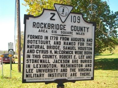
Rockbridge County. Area 616 Square Miles. Formed in 1778 from Augusta and Botetourt, and named for the Natural Bridge. Samuel Houston and Cyrus H. McCormick were born in this county. Robert E. Lee and Stonewall Jackson are buried in Lexington. Washington and Lee University and the Virginia Military Institute are there.
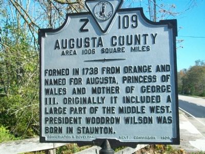
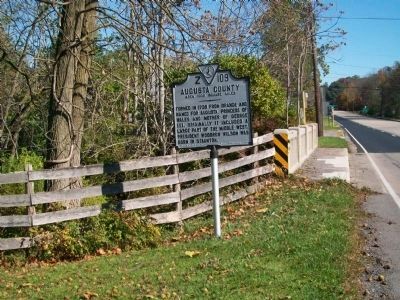
Augusta County. Area 1006 Square Miles. Formed in 1738 from Orange and named for Augusta, Princess of Wales and mother of George III. Originally it included a large part of the middle west. President Woodrow Wilson was born in Staunton.
Erected 1929 by Conservation and Development Commission. (Marker Number Z-109.)
Topics and series. This historical marker is listed in these topic lists: Bridges & Viaducts • Cemeteries & Burial Sites • Colonial Era • Education • Environment • Political Subdivisions • Settlements & Settlers • War, US Civil • Women. In addition, it is included in the Former U.S. Presidents: #28 Woodrow Wilson, and the Virginia Department of Historic Resources (DHR) series lists. A significant historical year for this entry is 1778.
Location. 37° 55.511′ N, 79° 12.222′ W. Marker
Other nearby markers. At least 8 other markers are within 7 miles of this marker, measured as the crow flies. Virginia Inventors (about 300 feet away, measured in a direct line); New Providence Church (about 600 feet away); Walnut Grove (approx. 0.7 miles away); The Marl Creek Interpretive Trail (approx. 0.7 miles away); Cyrus H. McCormick (approx. ¾ mile away); Old Providence Church (approx. 1½ miles away); New Providence Presbyterian Church (approx. 5.7 miles away); Cherry Grove Estate (approx. 6.3 miles away). Touch for a list and map of all markers in Raphine.
Credits. This page was last revised on July 9, 2021. It was originally submitted on October 28, 2009, by Kathy Walker of Stafford, Virginia. This page has been viewed 740 times since then and 25 times this year. Photos: 1, 2, 3, 4. submitted on October 28, 2009, by Kathy Walker of Stafford, Virginia. • Kevin W. was the editor who published this page.


