Parsons in Tucker County, West Virginia — The American South (Appalachia)
Corricks Ford Battlefield
Tale of the Monuments
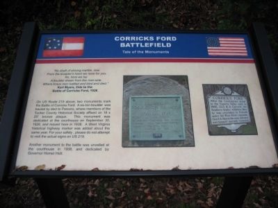
From the sculptor's hand we raise for you
No, here we lay
A boulder drawn from the river-side
Where brave men battled and bled and died."
Karl Myers, Ode to the
Battle of Corricks Ford, 1926
On US Route 219 above, two monuments mark the Battle of Corricks Ford. A six-ton boulder was hauled by sled to Parsons, where members of the Tucker County Historical Society affixed an 18 x 20" bronze plaque. This monument was dedicated at the courthouse on September 30, 1926, and moved here in 1938. A West Virginia historical highway marker was added about the same year. For your safety, please do not attempt to visit the actual signs on US 219.
Another monument to the battle was unveiled at the courthouse in 1938, and dedicated by Governor Homer Holt.
Topics. This historical marker is listed in this topic list: War, US Civil. A significant historical month for this entry is September 1711.
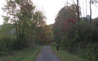
Location. 39° 5.282′ N, 79° 41.099′ W. Marker is in Parsons, West Virginia, in Tucker County. Marker is on Appalachian Highlands Trail, a walking trail, on the right when traveling east. The trail in the Corricks Ford Battlefield Park parallels U.S. 219. Touch for map. Marker is in this post office area: Parsons WV 26287, United States of America. Touch for directions.
Other nearby markers. At least 8 other markers are within walking distance of this marker. A different marker also named Corricks Ford Battlefield (a few steps from this marker); This Stone Commemorates the Battle of Corricks Ford (a few steps from this marker); Corrick's Ford (a few steps from this marker); a different marker also named Corricks Ford (about 400 feet away, measured in a direct line); The Corrick House (about 600 feet away); Clash at Corricks Ford (approx. 0.2 miles away); a different marker also named Corricks Ford Battlefield (approx. ¼ mile away); Historic Western Maryland Railway Depot / Parsons Railroad Depot (approx. 0.6 miles away). Touch for a list and map of all markers in Parsons.
Credits. This page was last revised on March 29, 2021. It was originally submitted on October 28, 2009, by Craig Swain of Leesburg, Virginia. This page has been viewed 2,002 times since then and 44 times this year. It was the Marker of the Week July 13, 2014. Photos: 1, 2. submitted on October 28, 2009, by Craig Swain of Leesburg, Virginia.

