Shockoe Slip in Richmond, Virginia — The American South (Mid-Atlantic)
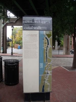
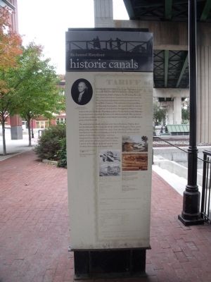
Canal Walk / Historic Canals
Richmond Riverfront
One hundred and fifty years ago, Richmond’s waterfront bustled with business and trade, workers and travelers, hotels, saloons, and tobacco warehouses. Along the canals, barges were towed by teams of horses and mules. Batteaux for carrying freight plied the river and the canal around the rapids, and passenger boats, called “packets,” left for Lynchburg every other day.
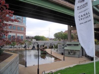
Richmond has now restored its historic canals. Once again, boats can bypass the beautiful but treacherous falls of the James River for a leisurely trip through the city. And a pedestrian path offers a walk through Richmond’s new riverfront district that is also a journey through four centuries of history.
Along Richmond’s riverfront are sites of millennia-old Indian trade routes and of early Colonial settlements. Tredegar Iron Works buildings have been restored, and the remains of bridges burned when the Confederates evacuated the city still stand. Tobacco warehouses, electric trolleys, and an early African American church have all left their mark. Their stories, and many others, are now told along the Richmond Riverfront Canal Walk.
historic canals
First envisioned by George Washington in 1774, the canals were to be part of a continuous transportation route from the Atlantic Ocean to the Mississippi River. By 1789, initial construction of portions of the canal around the falls to the west of downtown had been completed by the James River Canal Company. Ultimately part of the James River and Kanawha Canal system, this canal entered the city from the west and ran behind the Tredegar Iron Works to a basin between 8th and 11th Streets. From there, a series of locks, known as the Tidewater Connection Locks, connected the basin to the Richmond Dock. Also completed by 1789 was a millrace, later known as the Haxall Canal, which was initially dug to power a local flour mill.
The canal system eventually extended as far west as Buchanan, Virginia. But it was the railroads, not the canals, that finally fulfilled Washington’s dream, and in doing so they spelled the end for the canals. Soon after the Civil War, rail lines were laid over the old canal towpaths, and except for two locks preserved at the bottom of 12th Street, these unique waterways disappeared from the city. That is until 1995, when public and private partners joined forces to restore a portion of the original canals and create the new riverfront district that can be enjoyed today.
Erected by Richmond Riverfront Canal Walk.
Topics. This historical marker is listed in these topic lists: Bridges & Viaducts • Industry & Commerce • Waterways & Vessels. A significant historical year for this entry is 1774.
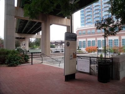
Location. 37° 32.018′ N, 77° 26.007′ W. Marker is in Richmond, Virginia. It is in Shockoe Slip. Marker is on Virginia Strret, 0.1 miles south of East Canal Street, on the left when traveling south. This marker is on the Richmond Riverfront Canal Walk. Touch for map. Marker is in this post office area: Richmond VA 23219, United States of America. Touch for directions.
Other nearby markers. At least 8 other markers are within walking distance of this marker. Tobacco District (a few steps from this marker); Atlantic Sturgeon (within shouting distance of this marker); James River & Kanawha Canal (within shouting distance of this marker); George Washington’s Vision (within shouting distance of this marker); New Turning Basin (within shouting distance of this marker); Burnt District (within shouting distance of this marker); James River Bateaumen (within shouting distance of this marker); Use of Arms (within shouting distance of this marker). Touch for a list and map of all markers in Richmond.
More about this marker. On the right side of the canal walk panel is a map of the Richmond Riverfront Canal Walk.
On the upper left is a portrait entitled, “George Washington Painting by Rembrandt Peale.” Courtesy of the Valentine Museum.
Right, top: Railroad ties being laid over the canal towpath, c. 1880. Courtesy of the Valentine Museum.
Right, below: Boats along the James River and Kanawha Canal. Sketch by J. R. Hamilton, 1865. Courtesy of the Valentine Museum.
Top: The James River and Kanawha Canal entering Richmond from the west. Aquatint of an engraving by W. J. Bennett from a painting by G. Cooke, 1834. Courtesy of the Valentine Museum.
Above: View of the canal running past the Virginia Manufactory of Arms and Tredegar Iron Works, Edward Beyer, 1857. Courtesy of the Valentine Museum.
Background, top: People overlooking the canal, c. 1865. Courtesy of the Library of Congress
Background: Broadside issued by the James River and Kanawha Company, 1844. Courtesy of the Library of Virginia
This marker is replicated along the Canal Walk.
Also see . . .
1. Richmond’s Historic Canal Walk. Venture Richmond (Submitted on October 30, 2009.)
2. James River and Kanawha Canal Historic District. National Register of Historic Places (Submitted on October 30, 2009.)
Credits. This page was last revised on February 1, 2023. It was originally submitted on October 30, 2009, by Bernard Fisher of Richmond, Virginia. This page has been viewed 1,023 times since then and 48 times this year. Photos: 1, 2, 3, 4. submitted on October 30, 2009, by Bernard Fisher of Richmond, Virginia.


