Central Office District in Richmond, Virginia — The American South (Mid-Atlantic)
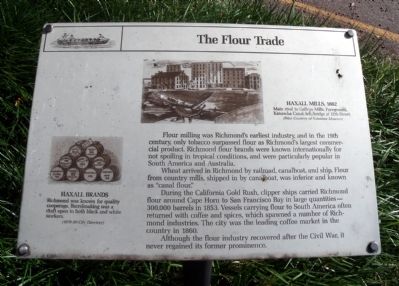
The Flour Trade
Wheat arrived in Richmond by railroad, canalboat, and ship. Flour from country mills, shipped in by canalboat, was inferior and known as "canal flour".
During the California Gold Rush, clipper ships carried Richmond flour around Cape Horn to San Francisco Bay in large quantities - 300,000 barrels in 1853. Vessels carrying flour to South America often returned with coffee and spices, which spawned a number of Richmond industries. The city was the leading coffee market in the country in 1860.
Although the flour industry recovered after the Civil War, it never regained its former prominence.
Topics. This historical marker is listed in these topic lists: Industry & Commerce • Waterways & Vessels. A significant historical year for this entry is 1853.
Location. 37° 32.092′ N, 77° 26.128′ W. Marker is in Richmond, Virginia. It is in the Central Office District. Marker is at the intersection of South 12th Street and East Canal Street, on the right when traveling north on South 12th Street. Touch for map. Marker is in this post office area: Richmond VA 23219, United States of America. Touch for directions.
Other nearby markers. At least 8 other markers are within walking distance of this marker. Inside A Flour Mill (here, next to this marker); Gallego Mills (a few steps from this marker); Tidewater Connection Locks (about 300 feet away, measured in a direct line); James River & Kanawha Canal (about 300 feet away); Gallego Mill Flume (about 400 feet away); Bowers Brothers Coffee and Tea Building (about 400 feet away); 1201 East Cary Street (about 400 feet away); The Center of Industry in 18th and 19th Century Richmond (about 400 feet away). Touch for a list and map of all markers in Richmond.
More about this marker. On the left is a sketch carrying the caption, "Haxall Brands. Richmond was known for quality cooperage. Barrelmaking was a craft open to both black and white workers. (1879-80 City Directory)
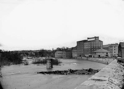
On the top right is a sketch carrying the caption, "Haxall Mils, 1882. Main rival to Gallego Mills. Foreground, Kanawha Canal; left, bridge at 12th Street. (Print Courtesy of Velentine Museum)
Credits. This page was last revised on February 1, 2023. It was originally submitted on October 31, 2009, by Bernard Fisher of Richmond, Virginia. This page has been viewed 1,041 times since then and 42 times this year. Last updated on November 1, 2009, by Jeff Conner of Norfolk, Virginia. Photos: 1, 2. submitted on October 31, 2009, by Bernard Fisher of Richmond, Virginia. 3. submitted on November 1, 2009, by Bernard Fisher of Richmond, Virginia.


