Near Mollusk in Lancaster County, Virginia — The American South (Mid-Atlantic)
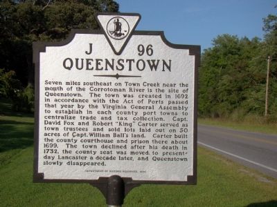
Queenstown
Erected 1999 by Department of Historic Resources. (Marker Number J-96.)
Topics and series. This historical marker is listed in this topic list: Colonial Era. In addition, it is included in the Virginia Department of Historic Resources (DHR) series list. A significant historical year for this entry is 1692.
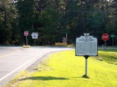
Location. 37° 44.754′ N, 76° 33.143′ W. Marker is near Mollusk, Virginia, in Lancaster County. Marker is at the intersection of Mary White Chapel Road (Virginia Route 201) and River Road (U.S. 354), on the right when traveling south on Mary White Chapel Road. Touch for map. Marker is in this post office area: Mollusk VA 22517, United States of America. Touch for directions.
Other nearby markers. At least 8 other markers are within 5 miles of this marker, measured as the crow flies. St. Mary’s Whitechapel (about 600 feet away, measured in a direct line); Trade Routes (approx. 2.9 miles away); St. Mary’s White Chapel (approx. 3.1 miles away); Birthplace of Washington’s Mother (approx. 3.7 miles away); Bewdley (approx. 3.9 miles away); Barford (approx. 4.3 miles away); Major Edward Dale (approx. 4.9 miles away); World War I Memorial (approx. 5 miles away).
Credits. This page was last revised on June 16, 2016. It was originally submitted on November 3, 2009, by J. J. Prats of Powell, Ohio. This page has been viewed 883 times since then and 32 times this year. Photos: 1. submitted on November 3, 2009, by J. J. Prats of Powell, Ohio. 2. submitted on November 4, 2009, by J. J. Prats of Powell, Ohio.
Editor’s want-list for this marker. Photos of the remains of Queenstown • Can you help?

