Wellford in Spartanburg County, South Carolina — The American South (South Atlantic)
Fort Prince
Inscription.
Located nearby, this fort protected early settlers from the Indians and served as camp for a detachment of militia en route to join the 1776 expedition against the Cherokees. The fort was headquarters in 1780 for a British garrison commanded by Colonel Alexander Innes.
Erected 1977 by Wellford Bicentennial Committee. (Marker Number 42-8.)
Topics. This historical marker is listed in these topic lists: Forts and Castles • War, US Revolutionary. A significant historical year for this entry is 1776.
Location. Marker is missing. It was located near 34° 57.75′ N, 82° 3.317′ W. Marker was in Wellford, South Carolina, in Spartanburg County. Marker was on Fort Prince Boulevard (State Highway 129) north of Interstate 85. Marker removed for relocation of I-85 and never replaced. Touch for map. Marker was in this post office area: Wellford SC 29385, United States of America. Touch for directions.
Other nearby markers. At least 10 other markers are within 4 miles of this location, measured as the crow flies. Kevin Earl Carper (approx. 0.2 miles away); Mount Zion Baptist Church Cemetery (approx. one mile away); Joshua Hawkins (approx. one mile away); Edward Bomar (approx. one mile away); In Honor of the Students of (approx. 2.6 miles away); Camp Wadsworth (approx. 3.3 miles away); Berlin Wall (approx. 3.4 miles away); District Five War Memorial (approx. 4 miles away); Colonel Warren H. Abernathy Highway (approx. 4 miles away); 15th N.Y. Infantry / Harlem Hell Fighters (approx. 4.1 miles away).
Also see . . .
1. Memorial Fort Prince. Newspaper clippings about the monument erected in remembrance of Fort Prince. Herald Journal, July 25, 1937 Referencing Musket balls and pottery nearby the creek. (Submitted on June 7, 2010, by Philippe Dekyvere of Moore, South Carolina.)
2. Wikipedia Prince's Fort. Also called Prince's Fort (Submitted on June 7, 2010, by Philippe Dekyvere of Moore, South Carolina.)
Additional commentary.
1. About Fort Prince
Built in 1756, Fort Prince had served the early frontier settlers as a refuge in times of Indian uprisings. It was occupied early in the war by the Patriots but later taken by the British, who occupied it in 1780. From this base, Col. Alexander Innes sent out a raiding party under Maj. James Dunlap, who encountered Americans in the area, most of whom were gathering to join forces with Col. Charles McDowell. They clashed at Gowen's

Photographed By Philippe Dekyvere
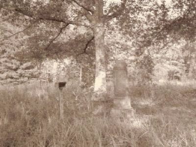
2. Fort Prince Marker
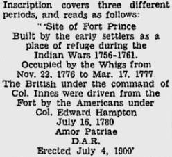
Engraving of the monument nearby : "
Site of Fort Prince Built by the early settlers as a place of refuge during the Indian wars 1756-1761. Occupied by the Wigs from Nov. 22 1776 to Mar. 17 1777.
The Brittish, under the command of col. Innes were driven from the fort by the Americans under Col. Edward Hampton Jul. 16 1780. Amor Patriae D.A.R. erected July 4 1900. "
— Submitted November 3, 2009, by Brian Scott of Anderson, South Carolina.
2. More About Fort Prince
Fort Prince was the scene of some spirited action in July 1780. That month, a Tory force from the British stronghold at Ninety Six moved north into Spartanburg County, where it suffered a series of stinging defeats, the first occurring on July 12 at Cedar Springs.
Before dawn on July 17, Captain Edward Hampton and his fifty-two men set out to find the retreating Tories. They encouraged them 5 miles from Fort Prince. When Hampton's men attacked, eight Tories fell on the spot. The others took flight and were pressed by the hard-charging Patriots until they reached the safety of Fort Prince, which was garrisoned by British soldiers under colonel Alexander Innes.
Like the other colonial forts in the area, Fort Prince was built to protect early settlers from the Indians. (Source: Touring South Carolina's Revolutionary War Sites by Daniel W. Barefoot (1999) pg 172-172.)
— Submitted November 3, 2009, by Brian Scott of Anderson, South Carolina.
3. Prince's Fort, South Carolina - 15 July 1780 (Skirmish)
After attacking McDowell's Camp on the Pacolet River, Dunlap and his men quickly retreated towards their base at Prince's Fort. Before the sun rose Hampton and his cavalry set off in pursuit. Edward Hampton was the brother of Wade, Richard and Henry Hampton in Sumter's army, and he wanted to exact revenge for the death of his son Noah.
Five miles from the fort Hampton caught Dunlap and his dragoons on the Blackstock Road, and attacked. Dunlap's men had been riding quietly and were unaware of their pursuers, when a volley of rifle fire tore into their ranks, killing five men. The Loyalists broke and fled to Prince's Fort, with Hampton's men hot on their heels. They made it to the fort, but only after they lost thirteen men killed, and one captured.
Three hundred yards from the fort Hampton held his men back, unsure of what was inside the fort. What he didn't know was that the only troops inside the fort were the men that they had been pursuing. Hampton returned to his camp with thirty-five horses, and the arms and equipment of the Provincials. He had only lost a single man who had been captured. His son, Noah, had been avenged.
Dunlap questioned their single prisoner and learned that McDowell's strength was around four hundred men. Dunlap sent word to Captain DePeyster of the attack, and then abandoned Prince's Fort. When DePeyster learned of the attack he immediately marched out with 100 American Volunteers and Loyalist militia to support Dunlap. The two parties met at McIlwain's Creek. (Source: Nothing but Blood and Slaughter: The Revolutionary War in the Carolinas, Volume Two 1780 by Patrick O' Kelley (2004) pg 203.)
— Submitted November 3, 2009, by Brian Scott of Anderson, South Carolina.
4. Noah Hampton - son of Col. Andrew Hampton
While some modern historians have assumed that since Capt. Edward Hampton led the pursuit of Dunlap and the Tories, Noah was his son. The foremost authority on the prelude to Kings Mountain was Lyman C. Draper in his "King's Mountain and its Heroes". Draper states clearly on page 81 of this book that Noah was the son of Colonel Andrew Hampton, commander of the Rutherford Militia. This fact is clearly stated on page 53 of Clarence Griffin's "History of Old Tryon and Rutherford County", as well.
If Noah had been the son of Edward, he would likely have been carried the short distance to the Earle Plantation for burial. Instead, traditon holds that he was buried near the battle site on the rising ground in what was then Rutherford County- now Polk- probably by his father, Col. Andrew Hampton, while Captain Edward Hampton was on the retaliation mission.
— Submitted August 30, 2010, by Chivous Bradley of Rutherfordton, North Carolina.
5.
The last time I was there the marker was still in place and was not missing. It was in a wooded area by cornfields. To get to it, we had to go up the driveway of a mobile home. The marker was behind several mobile homes, and if we had not known exactly where it was located we never would have found it. (I-85 to Exit 68, then take Hwy 129 South towards Greer to first right turn onto Fort Prince Road. Go about 1/4 mile on Fort Prince Road, see Cemetery on left. D.A.R. marker is on the right by the cornfield.) I am a descendant of John Prince who is credited with building the fort, and I have visited the site several times.
— Submitted October 28, 2013, by Deborah Kroll of Sautee Nacoochee, Georgia.
Credits. This page was last revised on June 16, 2016. It was originally submitted on November 3, 2009, by Brian Scott of Anderson, South Carolina. This page has been viewed 3,869 times since then and 120 times this year. Photos: 1. submitted on November 3, 2009, by Brian Scott of Anderson, South Carolina. 2. submitted on June 7, 2010, by Philippe Dekyvere of Moore, South Carolina.
