Near Weems in Lancaster County, Virginia — The American South (Mid-Atlantic)
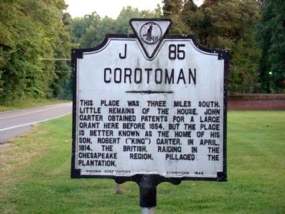
Corotoman
Erected 1948 by Virginia Conservation Commission. (Marker Number J-85.)
Topics and series. This historical marker is listed in these topic lists: Colonial Era • Notable Places • War of 1812. In addition, it is included in the Virginia Department of Historic Resources (DHR) series list. A significant historical month for this entry is April 1814.
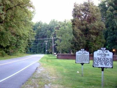
Location. 37° 40.883′ N, 76° 25.4′ W. Marker is near Weems, Virginia, in Lancaster County. Marker is on Christ Church Road (County Route 646) just south of Weems Road (Virginia Route 222), on the left when traveling north. It is at Christ Church. Touch for map. Marker is in this post office area: Weems VA 22576, United States of America. Touch for directions.
Other nearby markers. At least 8 other markers are within 3 miles of this marker, measured as the crow flies. Christ Church (here, next to this marker); Christ Church Lancaster (about 300 feet away, measured in a direct line); Virginia Founders, Revolutionary War Patriots and War of 1812 Veterans (about 300 feet away); Foundation for Historic Christ Church, Inc. (about 300 feet away); Site of Robert Carter's Brick Kiln (about 500 feet away); Irvington World War I Memorial (approx. 1.4 miles away); A. T. Wright High School (approx. 2.8 miles away); Albert Terry Wright (approx. 2.9 miles away). Touch for a list and map of all markers in Weems.
Also see . . . Corotoman. “Robert Carter began construction of the large Georgian mansion at Corotoman around 1720. The mansion was completed in 1725, and introduced a new era for early 18th century architecture in Virginia. Corotoman also set the pattern for 18th century architectural patronage. The mansion at Corotoman rivaled the other important Colonial mansions of Virginia, and affirmed Robert [“King”]Carter I’s status as the most powerful planter in the aristocracy of the Tidewater region.”
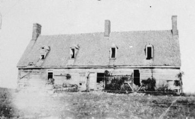
“In 1729, four years after ‘King’ Carter’s mansion was completed, a fire destroyed it. Carter made little mention of the mansion fire in his diary, but did lament the total destruction of his wine cellar. Carter died three years later and the mansion was not rebuilt. An inventory taken in 1732 after Carter’s death implies that after the fire, Carter resided in either the ‘Old House’ or the ‘Spinster’s House’ at Corotoman rather than rebuild it because of fiscal difficulties or ill health.” (Submitted on November 8, 2009.)

Photographed By Marietta Andrews (attributed to), circa 1900
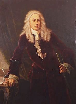
3. Robert Carter I (c. 1662, 1732) "King Carter"
Agent of Thomas Fairfax, 6th Lord Fairfax of Cameron, the proprietary of the Northern Neck (1702-1711 and 1722-1732), and acting colonial Governor of Virginia in 1726. Photo of portrait courtesy of Wikimedia Commons.
Credits. This page was last revised on June 16, 2016. It was originally submitted on November 8, 2009, by J. J. Prats of Powell, Ohio. This page has been viewed 2,331 times since then and 68 times this year. Photos: 1, 2, 3, 4. submitted on November 8, 2009, by J. J. Prats of Powell, Ohio.


