Alviso in Santa Clara County, California — The American West (Pacific Coastal)
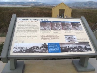
Water Everywhere
Water Seeks Its Own Level
More recently, Alviso also experienced the extreme of no water. Suburban and industrial growth and salt pond construction silted in or closed off much of Alviso’s waterways. This drastically altered the amount of water that naturally flushed this wetland area, endangering the region’s environmental health.
The re-channeling of the Guadalupe River and the outflow from the nearby sewage treatment plant have also impacted the level, flow, and quality of water in Alviso.
[Text of Timeline Aerial Photos:]
Development has changed the Alviso area in the fifty-year span of the photographs above. Salt ponds, development, and the resulting siltation have filled in the shoreline and blocked many waterways. To aid flood control, the course of the Guadalupe River has been straightened and channelized.
Aerial photo Above: Courtesy of Pacific Aerial Survey.
Erected by Santa Clara County Parks and the Santa Clara Valley Water District.
Topics and series. This historical marker is listed in these topic lists: Environment • Industry & Commerce • Waterways & Vessels. In addition, it is included in the Juan Bautista de Anza National Historic Trail series list.
Location. 37° 25.807′ N, 121° 58.784′ W. Marker is in Alviso, California, in Santa Clara County. Marker is on Hope Street. Marker is on the trail of the Alviso Marina County Park. Touch for map. Marker is in this post office area: Alviso CA 95002, United States of America. Touch for directions.
Other nearby markers. At least 8 other markers are within walking distance of this marker. Discover Alviso’s Rich History (within shouting distance of this marker); The Steamboat Jenny Lind Disaster (within shouting distance of this marker); The Port and Town of Alviso (within shouting distance of this marker); Salt Ponds (about 400 feet away, measured in a direct line); Location, Location, Location (about 500 feet away); China Camp (about 700 feet away); Bayside Cannery (about 700 feet away); Union Warehouse and Docks (approx. 0.2 miles away). Touch for a list and map of all markers in Alviso.
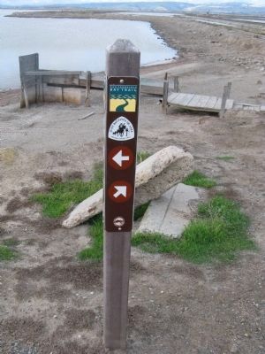
More about this marker. This trail is also part of the San Francisco Bay
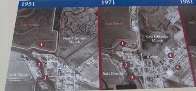
2. Timeline Aerial Photos 1951 and 1971
2. Slough appears to be clear and open waterway.
3. A small marina exists on the slough.
2. Slough appears to be clear and open waterway.
3. Marina on slough is gone.
4. Alviso grows.
Also see . . . A KTEH TV Production of the DeAnza Trail on YouTube. In this video one learns the history and purpose of the DeAnza Expedition, the heritage of descendants of members of the expedition, and current sites near the Bay Area along the trail. (Submitted on November 21, 2009, by Syd Whittle of Mesa, Arizona.)
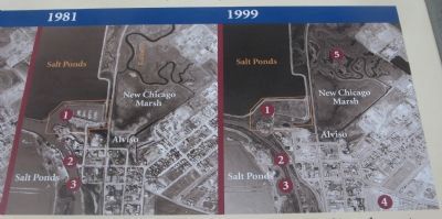
3. Timeline Aerial Photos 1981 and 1999
2. Slough is clear and open with many boats along shore.
3. Old marina is filled in.
2. Slough is much narrower.
3. Old marina and slough filled in.
4. Alviso grows.
5. Waterways are less apparent.

6. Close-Up of Photo on Marker
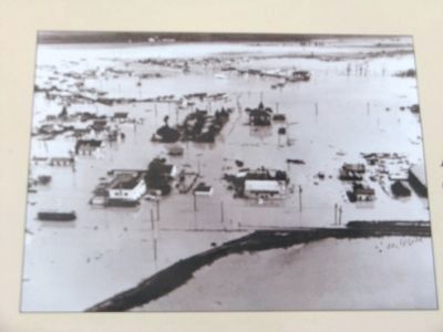
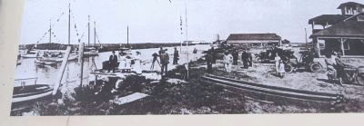
Taken 100 years apart in approximately the same spot, these two photos reveal the impact of ground subsidence. A 1934 survey reported that Alviso was sinking at a rate of one foot per every five years, making the land susceptible to flooding and unsuitable agriculture.
Photos: Courtesy of County of Santa Clara.
Photos: Courtesy of County of Santa Clara.
Credits. This page was last revised on February 7, 2023. It was originally submitted on November 11, 2009, by Syd Whittle of Mesa, Arizona. This page has been viewed 1,412 times since then and 14 times this year. Photos: 1, 2, 3, 4, 5, 6. submitted on November 11, 2009, by Syd Whittle of Mesa, Arizona. 7. submitted on November 12, 2009, by Syd Whittle of Mesa, Arizona.
