West Harrison in Westchester County, New York — The American Northeast (Mid-Atlantic)
The War for American Independence
The War for American Independence
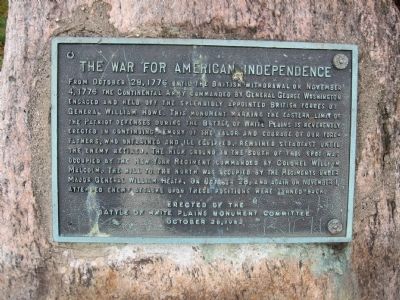
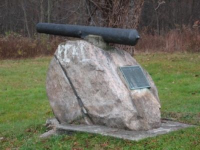
From October 28, 1776 until the British withdrawal on November 4, 1776 the Continental Army commanded by General George Washington engaged and held off the splendidly appointed British forces of General William Howe. This monument marking the eastern limit of the Patriot defenses during the Battle of White Plains is reverently erected in continuing memory of the valor and courage of our Forefathers, who untrained and ill equipped, remained steadfast until the enemy retired. The high ground to the south of this spot was occupied by the New York Regiment of Colonel William Malcolm. The hill to the north was occupied by the regiments under Major General William Heath. On October 28, and again on November 1, attempted enemy attacks upon these positions were turned back.
Erected 1962 by The Battle of White Plains Monument Committee.
Topics. This historical marker is listed in this topic list: War, US Revolutionary. A significant historical month for this entry is October 1897.
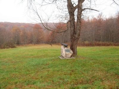
Location. 41° 2.897′ N, 73° 44.507′ W. Marker is in Harrison, New York, in Westchester County. It is in West Harrison. Marker is on Boulevard, 0.1 miles west of Old Lake Street, on the right when traveling west. Touch for map. Marker is at or near this postal address: 230 Lake St, West Harrison NY 10604, United States of America. Touch for directions.
Other nearby markers. At least 8 other markers are within 2 miles of this marker, measured as the crow flies. Merritt Hill (within shouting distance of this marker); a different marker also named Merritt Hill (about 500 feet away, measured in a direct line); VFW Post 5463 Veterans Memorial (approx. 0.4 miles away); West Harrison Honor Roll (approx. 0.6 miles away); North Castle World War II Monument (approx. 1.4 miles away); Joseph T. Miller (approx. 1.4 miles away); American Red Cross in Westchester County (approx. 1.4 miles away); Center of Washington’s Army (approx. 1½ miles away). Touch for a list and map of all markers in Harrison.
Credits. This page was last revised on August 7, 2023. It was originally submitted on November 12, 2009, by Michael Herrick of Southbury, Connecticut. This page has been viewed 1,336 times since then and 20 times this year. Photos: 1, 2, 3. submitted on November 12, 2009, by Michael Herrick of Southbury, Connecticut. • Bill Pfingsten was the editor who published this page.


