Fayetteville in Cumberland County, North Carolina — The American South (South Atlantic)
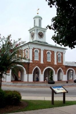
The Market House
Site of a Shootout
— Carolinas Campaign —
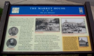
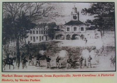
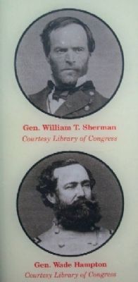
On Saturday morning, March 11, 1865, a brief skirmish took place here at the Market House as Confederate forces evacuated Fayetteville while Union Gen. William T. Sherman's army entered the town. A rear guard detachment under Gen. Wade Hampton surprised a Union cavalry patrol after one of the Federals came around the corner from Russell Street and then fired at Hampton on the south side of the Market House. In the ensuing engagement, several Union cavalrymen were killed or captured. Within a few hours, Hampton's forces had departed, burning the Clarendon Bridge behind them.
To save the building from destruction, Mayor Archibald McLean and a majority of the seven town commissioners went to Sherman's lines on March 11 and negotiated the peaceful surrender of the town. During Sherman's occupation of Fayetteville, Federal soldiers flew a United States flag from the Market House cupola.
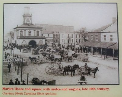
After the Civil War, the Market House remained an important part of the civic and economic life of Fayetteville, functioning as an open market into the 20th century. The upstairs rooms still serve as meeting space.
[Sidebar at lower right]:
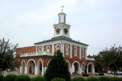
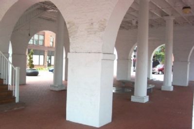
On this site in 1789, in a building called the State House, the North Carolina General Assembly met in the upper chamber to ratify the U.S. Constitution, cede the state's western territory to form Tennessee, and charter the University of North Carolina. The Great Fire of 1831 destroyed the old State House, and the present Market House was built on the same site in 1832. It was Fayetteville's economic and civic center, with an open market in the arcade and a town hall on the floor above. Occasionally, estate sales of small numbers of slaves occurred here.
Erected by North Carolina Civil War Trails.
Topics and series. This historical marker is listed in this topic list: War, US Civil. In addition, it is included in the North Carolina Civil War Trails series list. A significant historical date for this entry is March 11, 1865.
Location. 35° 3.161′ N, 78° 52.691′ W. Marker is in Fayetteville, North Carolina, in Cumberland County. Marker is at the intersection of Green Street and Market Square, on the right when traveling north on Green Street. Touch for map. Marker is in this post office area: Fayetteville NC 28301, United States of America. Touch for directions.
Other nearby markers. At least 8 other markers are within walking distance of this marker. Old Town Hall (a few steps from this marker); Town House (within shouting distance of this marker); Plank Roads (within shouting distance of this marker); Charter of the University of N. C. (within shouting distance of this marker); Flora MacDonald (within shouting distance of this marker);
James Dobbin McNeill (within shouting distance of this marker); First Presbyterian Church (about 400 feet away, measured in a direct line); Liberty Point (about 500 feet away). Touch for a list and map of all markers in Fayetteville.
Also see . . . History of Fayetteville. (Submitted on November 12, 2009, by William Fischer, Jr. of Scranton, Pennsylvania.)
Credits. This page was last revised on June 16, 2016. It was originally submitted on November 12, 2009, by William Fischer, Jr. of Scranton, Pennsylvania. This page has been viewed 1,441 times since then and 40 times this year. Photos: 1, 2, 3, 4, 5, 6, 7, 8, 9. submitted on November 12, 2009, by William Fischer, Jr. of Scranton, Pennsylvania.
