Beverly in Randolph County, West Virginia — The American South (Appalachia)
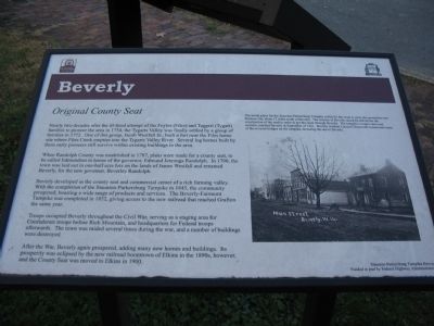
Beverly
Original County Seat
When Randolph County was established in 1787, plans were made for a county seat, to be called Edmundton in honor of the governor, Edmund Jennings Randolph. In 1790, the town was laid out in one-half acre lots on the lands of James Westfall and renamed Beverly, for the new governor, Beverly Randolph.
Beverly developed as the county seat and commercial center of a rich farming valley. With the completion of the Staunton-Parkersburg Turnpike in 1845, the community prospered, boasting a wide range of products and services. The Beverly-Fairmont Turnpike was completed in 1852, giving access to the new railroad that reached Grafton the same year.
Troops occupied Beverly throughout the Civil War, serving as a staging area for Confederate troops before Rich Mountain, and headquarters for Federal troops afterwards. The town was raided several times during the war, and a number of buildings were destroyed.
After the War, Beverly again prospered, adding many new homes and buildings. Its prosperity was eclipsed by the new railroad boomtown of Elkins in the 1890s, however, and the County Seat was moved to Elkins in 1900.
Erected by Staunton Parkersburg Turnpike and Historic Beverly, W.Va.
Topics. This historical marker is listed in these topic lists: Government & Politics • Roads & Vehicles • Settlements & Settlers • War, US Civil. A significant historical year for this entry is 1754.
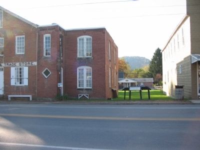
Location. 38° 50.459′ N, 79° 52.521′ W. Marker is in Beverly, West Virginia, in Randolph County. Marker is on Main Street (U.S. 219), on the right when traveling south. Located next to the Randolph County Museum and Historical Society. Touch for map. Marker is in this post office area: Beverly WV 26253, United States of America. Touch for directions.
Other nearby markers. At least 8 other markers are within walking distance of this marker. The First Campaign (here, next to this marker); a different marker also named Beverly (here, next to this marker); Occupied Beverly (here, next to this marker); Blackman-Bosworth Store (here, next to this marker); a different marker also named Beverly (a few steps from this marker); Robert Foyles & Family (a few steps from this marker); Randolph Co Jail - 1813 (a few steps from this marker); Beverly Public Square (within shouting distance of this marker). Touch for a list and map of all markers in Beverly.
More about this marker. On the right is a photo of Main Street Beverly. The initial plans for the Staunton-Parkersburg Turnpike called for the route to cross the mountain near Huttonsville, about 12 miles south of Beverly. The citizens of Beverly raised $3,200.00 for the construction of the road in order to get the route through Beverly. The turnpike, a major east-west corridor, reached Beverly in September of 1841. Beverly resident Lemuel Chenoweth constructed many of the covered bridges on the turnpike, including the one in Beverly.
Also see . . . Historic Beverly. Short history of the town from the Historic Beverly web site. (Submitted on November 15, 2009, by Craig Swain of Leesburg, Virginia.)
Credits. This page was last revised on June 16, 2016. It was originally submitted on November 15, 2009, by Craig Swain of Leesburg, Virginia. This page has been viewed 941 times since then and 45 times this year. Photos: 1, 2. submitted on November 15, 2009, by Craig Swain of Leesburg, Virginia.

