Central Business District in Cincinnati in Hamilton County, Ohio — The American Midwest (Great Lakes)
1749 French Claims to Ohio River Valley
Inscription.
Side A:
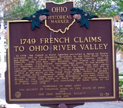
In 1749, the French in North America perceived a threat by British expansion west of the Allegheny Mountains to the Ohio River Valley and beyond. The French commander, Pierre Joseph Celeron, sieur de Blainville, with 250 men, left Montreal, New France, to establish French claims. They buried inscribed lead plates at the mouths of six important tributaries to the Ohio River. Three lead plates have been recovered, one was sent to England, and two are in American historical societies. The final plate was buried just west of here at the mouth of the Great Miami River, before the detachment turned north. However, after the British captured Montreal in 1760, French claims east of the Mississippi River were ceded to Britain by the 1763 Treaty of Paris. British Parliament annexed to Quebec (now Canada) and controlled all lands north of the Ohio River until 1776.
(Continued on other side)
Side B:
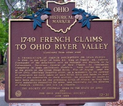
(Continued from other side)
A translation of French inscription on lead plates:
In 1749, in the reign of Louis XV, King of France, we, Celeron, Commander of the detachment sent by Monsieur the Marquis de la Galissoniere, Governor General of New France, to reestablish tranquility in some uncivilized districts, have buried this plate at the mouth of the Great Miami River, 31st of August, near the River Ohio, otherwise Beautiful River, as a monument to the renewal of possession we have taken of said River Ohio and lands on both sides of its tributaries to their sources, as enjoyed or ought to have been enjoyed by the preceding Kings of France, as they have there maintained themselves by arms, and especially by the treaties of Ryswick, Utrecht, and Aix La Chapelle.
Erected 1994 by The Society of Colonial Wars in the State of Ohio and The Ohio Historical Society. (Marker Number 12-31.)
Topics and series. This historical marker is listed in these topic lists: Colonial Era • Exploration • Patriots & Patriotism • Settlements & Settlers • Waterways & Vessels. In addition, it is included in the Ohio Historical Society / The Ohio History Connection series list. A significant historical year for this entry is 1749.
Location. 39° 6.001′ N, 84° 29.928′ W. Marker is in Cincinnati, Ohio, in Hamilton County. It is in the Central Business District. Marker is along the Ohio River in Sawyer Point Park, about 60 feet southeast of the Cincinnatus statue, and about 150 feet east of the Newport Southbank pedestrian bridge (former Louisville & Nashville Railroad bridge). Touch for map. Marker is at or near this postal address: 801 East Pete Rose Way, Cincinnati OH 45202, United States of America. Touch for directions.
Other nearby markers. At least 8 other markers
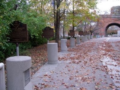
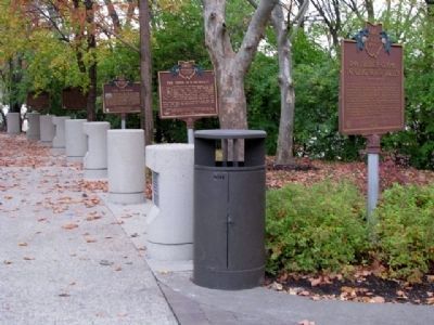
are within walking distance of this marker. The Irish in Cincinnati (here, next to this marker); The Sultana (here, next to this marker); Cincinnati's German Heritage (a few steps from this marker); The Black Brigade of Cincinnati (a few steps from this marker); Lucius Quinctius Cincinnatus (a few steps from this marker); Bicentennial Commons at Sawyer Point (within shouting distance of this marker); Ohio’s First Publicly Owned Water System (approx. ¼ mile away); Corporal Merrill Laws Ricketts Marine Corps Memorial (approx. ¼ mile away). Touch for a list and map of all markers in Cincinnati.
Credits. This page was last revised on February 4, 2023. It was originally submitted on November 16, 2009, by William Fischer, Jr. of Scranton, Pennsylvania. This page has been viewed 5,227 times since then and 134 times this year. Photos: 1, 2, 3, 4. submitted on November 16, 2009, by William Fischer, Jr. of Scranton, Pennsylvania.


