Patterson in Putnam County, New York — The American Northeast (Mid-Atlantic)
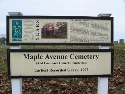
Maple Avenue Cemetery
Patterson 200 Years
(And Combined Church Cemeteries)
Earliest Recorded Grave, 1792
The Combined Cemeteries
At the close of the Revolution, in 1782, when all the lands of Beverly Robinson were seized by the State Legislature and sold at auction, a half-acre parcel on the road from New England to the Hudson in the town of Fredericksburgh was reserved for the Episcopal Church and a burying ground. A portion of this piece of land was the start of the combined cemeteries which are here today. The earliest recorded grave here is that of Thomas Flemming who died in 1792.
In 1803, a committee from Christ Church was appointed to confer with the Presbyterian Society about the burying ground which that congregation had located eight years earlier, along with their new meeting house, on adjoining land. Revolutionary War veterans, including Henry Ludington (who died in 1817), his daughter Sybil and other early members of both congregations are buried in the combined churchyards. Some, like the Rev. David Close who died in 1783 and was originally buried in the Old Meeting House cemetery (north of the Triangle Inn Corner) were relocated here. The rear portion of the Old Presbyterian Cemetery did not come into use until 1849, after the demolition of the 1795 Meeting House and the construction of the present Presbyterian Church building in 1838.
As the church cemeteries filled up, the Maple Avenue Cemetery Association was formed. In 1863 the trustees bought land along Maple Avenue just north of and adjacent to them. The first sections were divided into family plots and include some Civil War graves. The names on the stones in these plots have a familiar ring to them, occurring often in street and place names within the Town, in the records of the churches and organizations, and on the War Monument at the corner of Maple Avenue. Since the initial portions of this cemetery were laid out, additional development has continued to the east and the north.
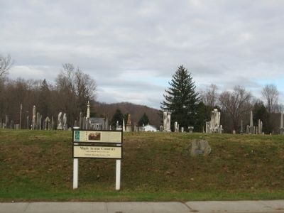
One of the best views of the proposed Historic District can be seen from the east of the Maple Avenue gate looking south over the original church lands. The scale and feeling of serenity suggests how this part of Patterson might have looked 100 years ago.
Topics. This historical marker is listed in these topic lists: Cemeteries & Burial Sites • Colonial Era. A significant historical year for this entry is 1792.
Location. 41° 30.842′ N, 73° 36.738′ W. Marker is in Patterson, New York, in Putnam County. Marker is at the intersection of New York State Route 311 and Maple Avenue, on the right when traveling west on State Route 311. Touch for map. Marker is in this post office area: Patterson NY 12563, United States of America. Touch for directions.
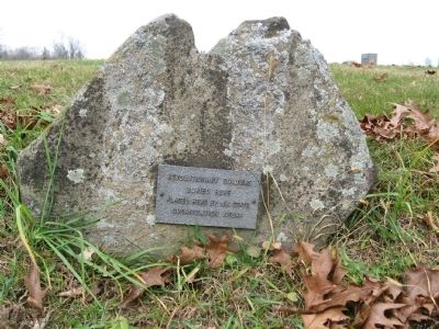
Other nearby markers. At least 8 other markers are within walking distance of this marker. Ludington Graves (here, next to this marker); District School No. 1 (a few steps from this marker); Patterson Grange No. 939 (within shouting distance of this marker); Christ Church (within shouting distance of this marker); The War Monument (within shouting distance of this marker); Patterson Veterans Monument (within shouting distance of this marker); The Presbyterian Church (within shouting distance of this marker); The Fellowship Hall (within shouting distance of this marker). Touch for a list and map of all markers in Patterson.
Also see . . . The Patterson Historic District 2. (Submitted on November 25, 2009, by Michael Herrick of Southbury, Connecticut.)
Credits. This page was last revised on June 16, 2016. It was originally submitted on November 24, 2009, by Michael Herrick of Southbury, Connecticut. This page has been viewed 1,414 times since then and 17 times this year. Photos: 1, 2, 3. submitted on November 24, 2009, by Michael Herrick of Southbury, Connecticut. • Kevin W. was the editor who published this page.


