Patterson in Putnam County, New York — The American Northeast (Mid-Atlantic)
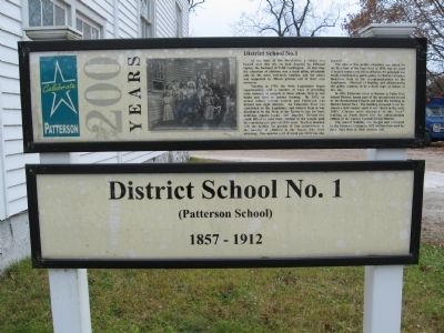
District School No. 1
Patterson 200 Years
(Patterson School)
1857 – 1912
At the time of the Revolution, a school was located near this site on land donated by Edmond Ogden, the husband of Sybil Ludington. At that time the education of children was a local affair, affordable only by the more well-to-do families, and the school was supported by fifteen patrons out of their own resources.
Starting in 1795, the State Legislature began experimenting with a number of ways of providing some measure of support to these schools., first in text books and later, in teacher training. By 1812, an actual school system existed and Patterson was divided into eight districts. An Education Fund was established by the Legislature and interest from it was distributed by the State to the Towns to pay for land, buildings, repairs, books, and supplies. Parents who could afford to send their children to the schools paid the remaining sixty percent of the costs. Teachers boarded with the families for periods of time proportional to the number of children in the family who were attending. One quarter cord of wood per child was also assessed.
The idea of free public education was raised for the first time at the State level in 1843, but six years of heated controversy followed before the principle was finally established as public policy in 1849 by Governor Hamilton Fish in his recommendations to the Legislature. Methods of funding and administering this policy continue to be a lively topic of debate to this day.
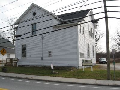
In 1853 Patterson voted to become a Union Free School District, leased part of the unused land owned by the Presbyterian Church and built this building as District School No. 1. The building remained in use for almost a half century until it was closed in the early 1900s. Classes were relocated to the “new” building on South Street, now the Administration Offices of the Carmel Central School District.
The unused building was bought and renovated by the Patterson Grange in 1912 and has been used by them since then as their meeting hall.
Topics. This historical marker is listed in this topic list: Education. A significant historical year for this entry is 1857.
Location. 41° 30.831′ N, 73° 36.738′ W. Marker is in Patterson, New York, in Putnam County. Marker is on New York State Route 311, 0.1 miles east of Maple Avenue, on the left when traveling west. Located in front of the Patterson Grange Hall (formerly Patterson School District 1). Touch for map. Marker is in this post office area: Patterson NY 12563, United States of America. Touch for directions.
Other nearby markers. At least 8 other markers are within walking distance of this marker. Patterson Grange No. 939 (a few steps from this marker); Ludington Graves (a few steps from this
marker); Maple Avenue Cemetery (a few steps from this marker); The War Monument (within shouting distance of this marker); Christ Church (within shouting distance of this marker); Patterson Veterans Monument (within shouting distance of this marker); The Fellowship Hall (within shouting distance of this marker); The Presbyterian Church (within shouting distance of this marker). Touch for a list and map of all markers in Patterson.
Also see . . . Patterson School Districts. (Submitted on November 25, 2009, by Michael Herrick of Southbury, Connecticut.)
Credits. This page was last revised on June 16, 2016. It was originally submitted on November 25, 2009, by Michael Herrick of Southbury, Connecticut. This page has been viewed 641 times since then and 17 times this year. Photos: 1, 2. submitted on November 25, 2009, by Michael Herrick of Southbury, Connecticut. • Syd Whittle was the editor who published this page.

