Rock Hill in York County, South Carolina — The American South (South Atlantic)
Ebenezer
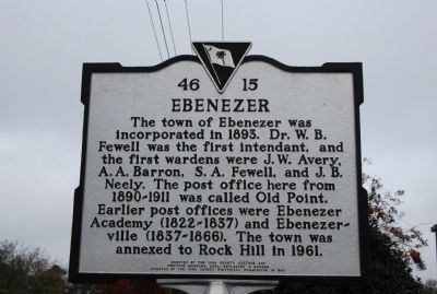
The town of Ebenezer was incorporated in 1893. Dr. W.B. Fewell was the first intendant, and the first wardens were J.W. Avery, A.A. Barron, S.A. Fewell, and J.B. Neely. The post office here from 1890-1911 was called Old Point. Earlier post offices were Ebenezer Academy (1822-1837) and Ebenezerville (1837-1866). The town was annexed to Rock Hill in 1961.
Erected 2005 by York County Culture and Heritage Museums, replacing a marker erected by the York County Historical Commission in 1980. (Marker Number 46-15.)
Topics and series. This historical marker is listed in this topic list: Notable Places. In addition, it is included in the Postal Mail and Philately, and the South Carolina, York County Historical Commission series lists. A significant historical year for this entry is 1893.
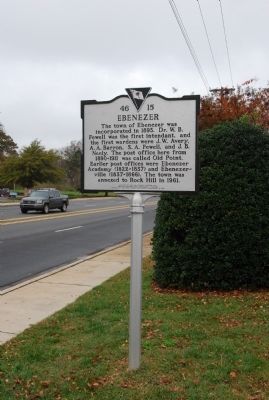
Location. 34° 57.426′ N, 81° 2.778′ W. Marker is in Rock Hill, South Carolina, in York County. Marker is at the intersection of Ebenezer Road (State Highway 274) and North Herlong Avenue (State Highway 728), on the right when traveling north on Ebenezer Road. Touch for map. Marker is in this post office area: Rock Hill SC 29732, United States of America. Touch for directions.
Other nearby markers. At least 10 other markers are within 2 miles of this marker, measured as the crow flies. The CCC in York County / Tom Johnston Camp, (SCS#10), CCC (approx. 0.3 miles away); Town of Ebenezer (approx. 0.7 miles away); Ebenezer Confederate Memorial (approx. 0.7 miles away); First Home of Winthrop College (approx. 1.4 miles away); Columbia Seminary Chapel (approx. 1.4 miles away); Jefferson Davis' Flight (approx. 1.6 miles away); McCorkle-Fewell-Long House / Oakland (approx. 1.7 miles away); President's House (approx. 1.7 miles away); Armstrong-Mauldin House (approx. 1.8 miles away); Oakland Avenue Baptist Church (approx. 1.8 miles away). Touch for a list and map of all markers in Rock Hill.
Credits. This page was last revised on June 16, 2016. It was originally submitted on November 25, 2009, by Michael Sean Nix of Spartanburg, South Carolina. This page has been viewed 953 times since then and 35 times this year. Photos: 1, 2. submitted on November 25, 2009, by Michael Sean Nix of Spartanburg, South Carolina. • J. J. Prats was the editor who published this page.

