Patterson in Putnam County, New York — The American Northeast (Mid-Atlantic)
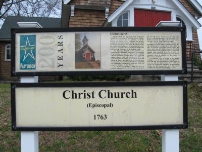
Christ Church
Patterson 200 Years
(Episcopal)
1763
The Episcopal Church in the Colonies was managed from England and was involved in the politics of the colonial government. Tory groups naturally gathered around the Episcopal clergy. As a result, the original church, while still standing in 1778, was closed during the Revolution. It is reported that it was used as an armory, guarded by the local militia under the command of Colonel Henry Ludington, because it was strategically located on the main road which ran from New England to the Hudson.
In 1782, Beverly Robinson’s lands were taken by the State and sold, but this site was held back from the sale and kept for the church and a cemetery. The church was incorporated under New York law in 1797. Matthew Paterson, then judge of the Dutchess County Court of Common Pleas, signed the papers.
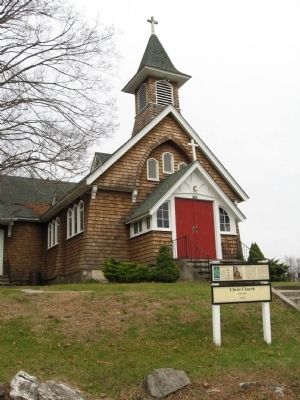
The congregation of Christ Church has worshipped in several different buildings on this site. The original church was taken down and replaced in 1814. In 1835 the congregation voted to replace that with a newer one and Trinity Church in New York donated almost 75 percent of the cost of a colonial style building which remained in use for 67 years. In 1902 it was torn down and replaced by a more modern structure, given in memory of the mother of Mrs. James Cornwall.
In February 1911, it burned to the ground. Nothing was saved. The loss to the congregation was great, but they were determined to rebuild within the year and with the help of many, both within and outside the congregation (including the Presbyterian Church and the grange), they did. The present building was dedicated on December 21, 1911.
Topics. This historical marker is listed in these topic lists: Churches & Religion • Colonial Era. A significant historical month for this entry is February 1911.
Location. 41° 30.842′ N, 73° 36.758′ W. Marker is in Patterson, New York, in Putnam County. Marker is at the intersection of New York State Route 311 and Maple Avenue, on the right when traveling west on State Route 311. Located in front of the Christ Church. Touch for map. Marker is in this post office area: Patterson NY 12563, United States of America. Touch for directions.
Other nearby markers. At least 8 other markers are within walking distance of this marker. The War Monument (a few steps from this marker); Patterson Veterans Monument (a few steps from this marker); Ludington Graves (a few steps from this marker); Maple Avenue Cemetery (within shouting distance of this marker); District School No. 1 (within shouting distance of this marker); Patterson Grange No. 939 (within shouting distance of this marker); The Presbyterian Church (within shouting distance of this marker); The Fellowship Hall (within shouting distance of this marker). Touch for a list and map of all markers in Patterson.
Also see . . . Patterson Historic District 2. (Submitted on November 27, 2009, by Michael Herrick of Southbury, Connecticut.)
Credits. This page was last revised on June 16, 2016. It was originally submitted on November 27, 2009, by Michael Herrick of Southbury, Connecticut. This page has been viewed 798 times since then and 16 times this year. Photos: 1, 2. submitted on November 27, 2009, by Michael Herrick of Southbury, Connecticut. • Bill Pfingsten was the editor who published this page.

