Beekman in Dutchess County, New York — The American Northeast (Mid-Atlantic)
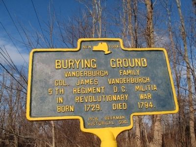
Burying Ground
Vanderburgh Family
Col. James Vanderburgh
5th Regiment D. C. Militia
In Revolutionary War
Born 1729. Died 1794.
Erected 1976 by Beekman Historical Society.
Topics. This historical marker is listed in these topic lists: Cemeteries & Burial Sites • War, US Revolutionary. A significant historical year for this entry is 1729.
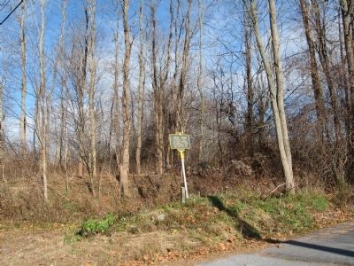
Location. 41° 36.894′ N, 73° 40.569′ W. Marker is in Beekman, New York, in Dutchess County. Marker is on New York State Route 55, 0.1 miles north of Connecting Road, on the right when traveling north. Touch for map. Marker is at or near this postal address: 2745 Route 55, Poughquag NY 12570, United States of America. Touch for directions.
Other nearby markers. At least 8 other markers are within 4 miles of this marker, measured as the crow flies. 1754 Homesite (about 600 feet away, measured in a direct line); The Old Upper Road (approx. 0.3 miles away); The Mill House (approx. 1.3 miles away); Site of Beekman Furnace (approx. 1.6 miles away); Pawling Beekman Turnpike (approx. 2.3 miles away); The West Mountain Mission (approx. 2.4 miles away); Town Line (approx. 3.6 miles away); Potters Corners Burying Ground (approx. 3.8 miles away). Touch for a list and map of all markers in Beekman.
Also see . . .
1. The Town of Beekman: A Brief History . Town Historian PDF (Submitted on November 27, 2009, by Michael Herrick of Southbury, Connecticut.)
2. Beekman, NY. Wikipedia entry (Submitted on November 27, 2009, by Michael Herrick of Southbury, Connecticut.)
Credits. This page was last revised on July 8, 2022. It was originally submitted on November 27, 2009, by Michael Herrick of Southbury, Connecticut. This page has been viewed 1,518 times since then and 50 times this year. Photos: 1, 2. submitted on November 27, 2009, by Michael Herrick of Southbury, Connecticut. • Bill Pfingsten was the editor who published this page.

