West Pawling in Dutchess County, New York — The American Northeast (Mid-Atlantic)
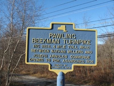
Pawling Beekman Turnpike
between Nathan Millers and
Joseph Arnolds commerce
opened to Pok. Abandoned 1906
Erected by Mr & Mrs Jr. I Arom.
Topics. This historical marker is listed in these topic lists: Industry & Commerce • Roads & Vehicles. A significant historical year for this entry is 1824.
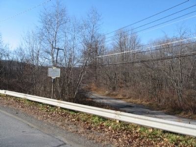
Location. 41° 35.142′ N, 73° 39.205′ W. Marker is in West Pawling, New York, in Dutchess County. Marker is at the intersection of Old Route 55 and Freedom Plains Road (New York State Route 55), on the left when traveling south on Old Route 55. Touch for map. Marker is in this post office area: Pawling NY 12564, United States of America. Touch for directions.
Other nearby markers. At least 8 other markers are within 3 miles of this marker, measured as the crow flies. The West Mountain Mission (within shouting distance of this marker); The Old Upper Road (approx. 2.3 miles away); 1754 Homesite (approx. 2.3 miles away); Burying Ground (approx. 2.3 miles away); Murrow Park (approx. 2.4 miles away); Cole’s Mill (approx. 2.4 miles away); Grange Hall (approx. 2.8 miles away); Lakeside Park (approx. 2.8 miles away).
Regarding Pawling Beekman Turnpike. Pok. - Abbreviation for Poughkeepsie? Google Maps shows this as Old Route 55. Current Route 55 continues north and west from here to Poughkeepsie.
Also see . . . Office of the Town Historian. Town website entry (Submitted on July 12, 2022, by Larry Gertner of New York, New York.)
Credits. This page was last revised on January 29, 2024. It was originally submitted on November 27, 2009, by Michael Herrick of Southbury, Connecticut. This page has been viewed 1,316 times since then and 51 times this year. Photos: 1, 2. submitted on November 27, 2009, by Michael Herrick of Southbury, Connecticut. • Kevin W. was the editor who published this page.

