Near Woodbridge in Prince William County, Virginia — The American South (Mid-Atlantic)
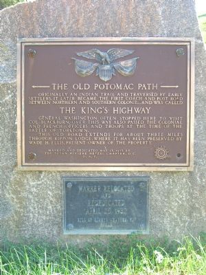
The Old Potomac Path
The Old Potomac Path
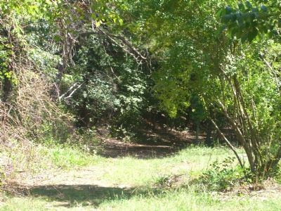
Originally an Indian Trail and traversed by early settlers, it later became the first coach and post road between Northern and Southern Colonies, and was called
The King’s Highway
General Washington often stopped here to visit Col. Blackburn. Over this way also passed the Colonial and French Officers and troops at the time of the Battle of Yorktown.
This old road extends for about three miles through Rippon Lodge, where it has been preserved by Wade H. Ellis, present owner of the property.
Marked and Dedicated May 13, 1933, by The Susan Riviere Hetzel Chapter, D.C., D.A.R.
Marker relocated and rededicated April 25, 1982, Bill of Rights Chapter, VA, NSDAR.
Erected 1933 by Susan Riviere Hetzel Chapter, The Susan Riviere Hetzel Chapter, Daughters of the American Revolution (DAR).
Topics and series. This historical marker is listed in these topic lists: Colonial Era • Native Americans • Roads & Vehicles • War, US Revolutionary. In addition, it is included in the Daughters of the American Revolution, the Former U.S. Presidents: #01 George Washington, and the George Washington Slept Here series lists. A significant historical date for this entry is April 25, 1743.
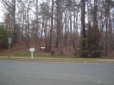
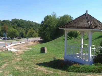
Location. 38° 37.172′ N, 77° 16.671′ W. Marker is near Woodbridge, Virginia, in Prince William County. Marker is at the intersection of Forest Grove Drive and Rippon Boulevard (County Route 784), on the right when traveling north on Forest Grove Drive. Touch for map. Marker is at or near this postal address: 15371 Forest Grove Dr, Woodbridge VA 22191, United States of America. Touch for directions.
Other nearby markers. At least 8 other markers are within walking distance of this marker. Preserving History (here, next to this marker); The Potomac Path (within shouting distance of this marker); Rippon Lodge (approx. ¼ mile away); Centuries of History (approx. ¼ mile away); Historic Landscape (approx. 0.3 miles away); Latrobe's View (approx. 0.3 miles away); a different marker also named Potomac Path (approx. 0.3 miles away); Neabsco Creek (approx. 0.4 miles away). Touch for a list and map of all markers in Woodbridge.
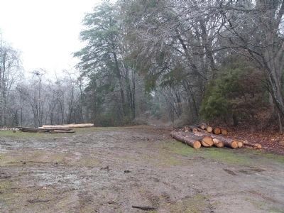
More about this marker. This is the third location for this marker. The previous location was 38° 37′ 8.21″ N, 77° 16′ 40.32″ W, directly across Rippon Boulevard from its current location.
Photographed By Kevin W., March 4, 2008
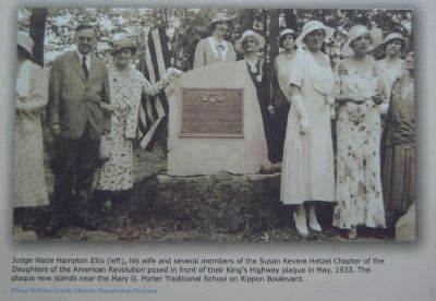
4. Picture of this marker's dedication in 1933.
Judge Wade Hampton Ellis (left), his wife and several members of the Susan Revere Hetzel Chapter of the Daughters of the American Revolution posed in front of their King’s Highway plaque in May, 1933.
Picture is from a nearby marker, recently installed by Prince William County.
Click for more information.
Picture is from a nearby marker, recently installed by Prince William County.
Click for more information.
Credits. This page was last revised on February 26, 2024. It was originally submitted on September 13, 2007, by Kevin W. of Stafford, Virginia. This page has been viewed 2,061 times since then and 35 times this year. Last updated on February 25, 2024, by Carolyn Sanders of Plano, Texas. Photos: 1. submitted on September 13, 2007, by Kevin W. of Stafford, Virginia. 2. submitted on March 4, 2008, by Kevin W. of Stafford, Virginia. 3. submitted on September 13, 2007, by Kevin W. of Stafford, Virginia. 4. submitted on March 4, 2008, by Kevin W. of Stafford, Virginia. 5, 6. submitted on September 13, 2007, by Kevin W. of Stafford, Virginia. 7. submitted on February 22, 2008, by Kevin W. of Stafford, Virginia. • Bernard Fisher was the editor who published this page.
