Marker Logo HMdb.org THE HISTORICAL
MARKER DATABASE
“Bite-Size Bits of Local, National, and Global History”
Providence in Orangeburg County, South Carolina — The American South (South Atlantic)
 

Walnut Grove Church


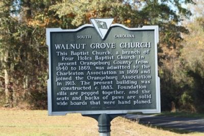
Walnut Grove Church Marker image. Click for full size.
Photographed By Mike Stroud, 2009
1. Walnut Grove Church Marker
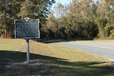
Inscription. This Baptist Church, a branch of Four Holes Baptist Church in present Orangesburg County from 1840 to 1869, was admitted to the Charleston Association in 1869 and joined the Orangeburg Association in 1913. The present building was constructed c. 1883. Foundation sills are pegged together, and the seats and backs of pews are solid wide boards that were hand planed.
 
Erected 1976 by The Congregation. (Marker Number 38-20.)
 
Topics. This historical marker is listed in this topic list: Churches & Religion. A significant historical year for this entry is 1840.
 
Location. 33° 24.52′ N, 80° 37.598′ W. Marker is in Providence, South Carolina, in Orangeburg County. Marker is on Landsdowne Road (State Highway 38-92). Located North of Arista Road. Touch for map. Marker is in this post office area: Bowman SC 29018, United States of America. Touch for directions.
 
Other nearby markers. At least 8 other markers are within 8 miles of this marker, measured as the crow flies. Bart's Corner (approx. 5.1 miles away); Providence Methodist Church (approx. 5.1 miles away); Captain Richard A Morris (approx. 5.2 miles away); Bowman War Memorial (approx. 5.2 miles away); Bowman S.C. (approx. 5.2 miles away); Bowman Rosenwald School (approx. 5.7
Paid Advertisement
Click on the ad for more information.
Please report objectionable advertising to the Editor.
Click or scan to see
this page online
miles away); White House Church (approx. 6˝ miles away); Astronaut Frank L. Culbertson, Jr. (approx. 7.7 miles away).
 
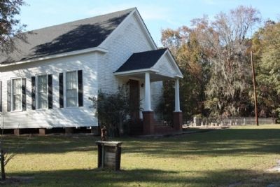
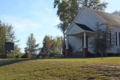
Walnut Grove Church and Marker image. Click for full size.
Photographed By Mike Stroud, November 15, 2009
2. Walnut Grove Church and Marker
Walnut Grove Church image. Click for full size.
Photographed By Mike Stroud, June 3, 2010
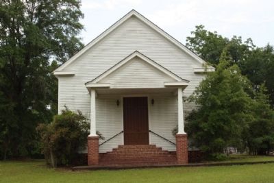
3. Walnut Grove Church
Walnut Grove Church image. Click for full size.
Photographed By Mike Stroud, November 15, 2009
4. Walnut Grove Church
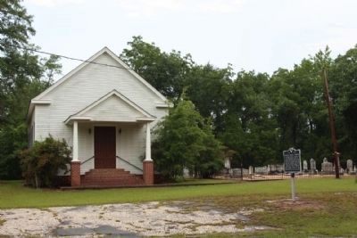
Walnut Grove Church Marker and Cemetery image. Click for full size.
Photographed By Mike Stroud, June 3, 2010
5. Walnut Grove Church Marker and Cemetery
Walnut Grove Church Marker, looking north along Landsdowne Road (State Road 38-92) image. Click for full size.
Photographed By Mike Stroud, November 15, 2009
6. Walnut Grove Church Marker, looking north along Landsdowne Road (State Road 38-92)
 
 
Credits. This page was last revised on June 16, 2016. It was originally submitted on November 29, 2009, by Mike Stroud of Bluffton, South Carolina. This page has been viewed 1,057 times since then and 24 times this year. Photos:   1, 2, 3, 4. submitted on November 29, 2009, by Mike Stroud of Bluffton, South Carolina.   5. submitted on June 3, 2010, by Mike Stroud of Bluffton, South Carolina.   6. submitted on November 29, 2009, by Mike Stroud of Bluffton, South Carolina. • Craig Swain was the editor who published this page.
Share this page.  
Share on Tumblr
m=24952

CeraNet Cloud Computing sponsors the Historical Marker Database.
This website earns income from purchases you make after using our links to Amazon.com. We appreciate your support.
Paid Advertisement
Apr. 23, 2024