Near Dodge in Delaware County, Oklahoma — The American South (West South Central)
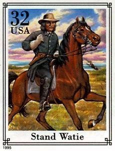
Stand Watie
Degataga Oo-Watee
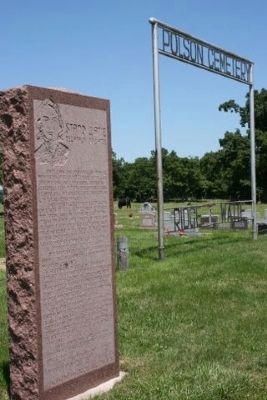
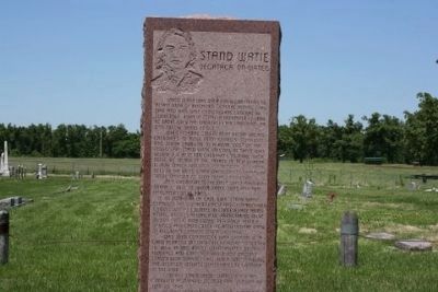
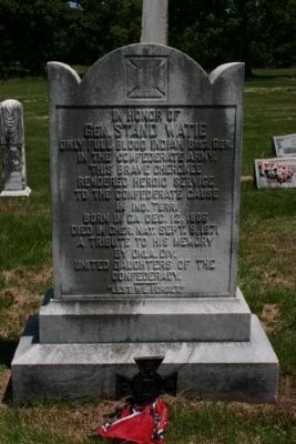
Stand Watie was only American Indian to attain rank of Brigadier General during Civil War and was last Confederate General to surrender. Born in Georgia, December 12, 1806. He spoke only the Cherokee language until he was twelve years of age. When the Federal government began urging Cherokees to move from Georgia, Tennessee and North Carolina to a home west of the Mississippi, Stand Watie was one of those who believed it best for Cherokees to make such a move. As signer of the treaty of New Echota in 1836 which provided for removal of Cherokees to the west, Stand Watie gained enmity of those opposed to such treaty provision. After removal to the west, Watie married Sarah C. Bell to whom three sons and two daughters were born. At outbreak of Civil War, Stand Watie espoused the southern cause and soon received commission as colonel in Confederate army. Among battles in which he participated were Wilson Creek, Bird Creek, Pea Ridge, Honey Springs and Cabin Creek. He attained the rank of Brigadier General on May 10, 1864.
Was joint commander with General R.M. Gano at Battle of Cabin Creek fought September 18, 1864. In this battle Confederates routed the Federals and captured about 300 wagons loaded with supplies thus, for a time, enabling the destitute Indian Confederates to continue in the war.
General Stand Watie surrendered his command at Doaksville, near Fort Towson on June 23, 1865. He died on September 9, 1871 A man of courage, leadership, and spirit.
Erected 1971 by Oklahoma Historical Society.
Topics and series. This historical marker is listed in these topic lists: Native Americans • War, US Civil. In addition, it is included in the Oklahoma Historical Society series list. A significant historical month for this entry is May 1854.
Location. 36° 31.536′ N, 94° 38.166′ W. Marker is in Near Dodge, Oklahoma, in Delaware County. Marker is on County Road E 340, on the right when traveling west. Located near the Oklahoma - Missouri State Line, near Southwest City, Missouri: take Cherokee St. in Southwest City (MO), West to Stand Watie Rd (E 342), follow it 1½ miles to Polson Cemetery,. Touch for map. Marker is in this post office area: Grove OK 74344, United States of America. Touch for directions.
Other nearby markers. At least 8 other markers are within 12 miles of this marker, measured as the crow flies. Fort Wayne (approx. 7.1 miles away); The Battle of Maysville (approx. 8.6 miles away in Arkansas); Camp Walker (approx. 8.8 miles away in Arkansas); Sulphur Springs Park Reserve (approx. 10.4 miles away in Arkansas); What Mean These Stones? (approx. 10.4 miles away in Arkansas); Camp Jackson / Confederate Dead (approx. 11.1 miles away in Arkansas); Georgia Cemetery (approx. 11.2 miles away in Arkansas); McDonald County (approx. 11.2 miles away in Missouri).
Also see . . . Stand Watie. American Battlefield Trust website entry (Submitted on April 9, 2022, by Larry Gertner of New York, New York.)
Credits. This page was last revised on April 9, 2022. It was originally submitted on December 15, 2009, by Mike Stroud of Bluffton, South Carolina. This page has been viewed 2,277 times since then and 65 times this year. Photos: 1, 2, 3, 4, 5. submitted on December 15, 2009, by Mike Stroud of Bluffton, South Carolina. • Craig Swain was the editor who published this page.
Editor’s want-list for this marker. Clear photo of marker. • Can you help?
