Near Fredericksburg in Spotsylvania County, Virginia — The American South (Mid-Atlantic)
McLaws Trail
The Battle of Fredericksburg
— Fredericksburg and Spotsylvania National Military Park —
Inscription.
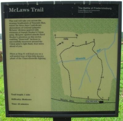
This trail will take you across the swampy headwaters of Ninemile Run, where for three days Confederate skirmishers of General Lafayette McLaws' division sparred with elements of Joseph Hooker's Union army. McLaws' spirited attacks fixed Hooker's attention on this sector, enabling "Stonewall" Jackson to successfully maneuver around the Union army's right flank, four miles ahead of you.
Fliers at Stop #1 will lead you on a self-guided tour of this little-known phase of the Chancellorsville fighting.
Trail length: 1 mile
Difficulty: Moderate
Time: 45 minutes
Erected by National Park Service, U.S. Department of the Interior.
Topics. This historical marker is listed in this topic list: War, US Civil.
Location. 38° 17.901′ N, 77° 37.096′ W. Marker is near Fredericksburg, Virginia, in Spotsylvania County. Marker is on McLaws Drive, on the right when traveling south. Touch for map. Marker is at or near this postal address: 8210 McLaws Ln, Fredericksburg VA 22407, United States of America. Touch for directions.
Other nearby markers. At least 8 other markers are within walking distance of this marker. Chancellorsville Campaign (approx. ¼ mile away); First Day at Chancellorsville (approx. 0.3 miles away); a different marker also named First Day at Chancellorsville (approx. 0.3 miles away); a different marker also named First Day at Chancellorsville (approx. 0.4 miles away); a different marker also named Chancellorsville Campaign (approx. 0.4 miles away); Bivouac (approx. 0.4 miles away); a different marker also named Chancellorsville Campaign (approx. half a mile away); A Bold Plan (approx. half a mile away). Touch for a list and map of all markers in Fredericksburg.
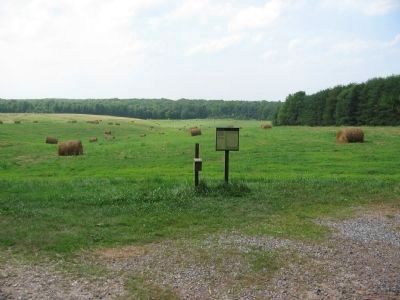
Photographed By Craig Swain, July 25, 2009
2. McLaws Trail Marker
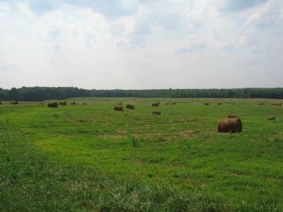
The marker stands at stop 1 of the trail, titled Union Advance and Retreat. The narrative on the trail guide notes the advance of Gen. George Sykes Federal V Corps to the area of Zoan Church to the east. Encountering Confederates, Sykes fell back to the ridge where the marker stands. Sykes was ordered to fall back further, to the Chancellorsville intersection, by his superior, General Joseph Hooker.
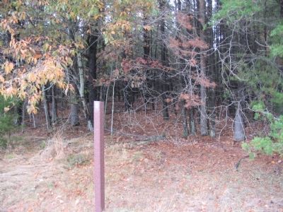
Photographed By Craig Swain, November 10, 2007
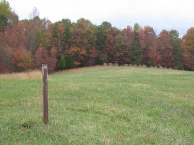
3. Trail Stop 2: The Wilderness
From the trail guide:
Much of the fighting at Chancellorsville occurred in thick woods known as the Wilderness. This area had been heavily logged earlier in the century to provide charcoal for the numerous iron furnaces that dotted the area. By the 1860's a young forest with dense underbrush, similar to the front of you, dominated the landscape west of Fredericksburg and south of the Rapidan and Rappahannock rivers. The open field in front of you was a tangled mess of small trees and dense undergrowth in 1863
Much of the fighting at Chancellorsville occurred in thick woods known as the Wilderness. This area had been heavily logged earlier in the century to provide charcoal for the numerous iron furnaces that dotted the area. By the 1860's a young forest with dense underbrush, similar to the front of you, dominated the landscape west of Fredericksburg and south of the Rapidan and Rappahannock rivers. The open field in front of you was a tangled mess of small trees and dense undergrowth in 1863
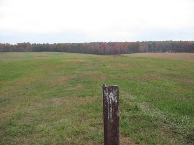
Photographed By Craig Swain, November 10, 2007
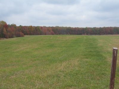
5. Trail Stop 4: May 1st Confederate Charge
General Sykes fell back to the wood line in the distance. Confederate General Henry Heth approached the position, at first considering a hasty assault, but was convinced to first make a probing attack. The 14th South Carolina assaulted on the north side of the Orange Turnpike (to the right of this photo) and was repulsed.
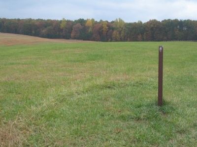
Photographed By Craig Swain, November 10, 2007
7. Trail Stop 6: Wounding of Nelson Miles
On May 3, fighting in this portion of the battlefield intensified. McLaws' Division, supported by Anderson's Division assaulted the Federal lines here, in consort with other Confederate attacks to the west. While inspecting his lines, Federal Colonel Nelson Miles was wounded in the stomach by a Confederate in the 10th Georgia Infantry. Miles would survive the wound and the war, raising to the rank of General-in-Chief of the Army.
Photographed By Craig Swain, November 10, 2007
9. Trail Stop 8: General Lee under Fire
In this vicinity on May 2, Federal shells crashed into a tree just above General Robert E. Lee. Eyewitnesses reported Lee appeared oblivious to the danger and only moved out of the line of fire when urged by subordinates.
Credits. This page was last revised on February 2, 2023. It was originally submitted on December 19, 2009, by Craig Swain of Leesburg, Virginia. This page has been viewed 1,430 times since then and 34 times this year. Photos: 1, 2, 3, 4, 5, 6, 7, 8, 9. submitted on December 19, 2009, by Craig Swain of Leesburg, Virginia.
