Fredericksburg, Virginia — The American South (Mid-Atlantic)
The Courthouse
Fredericksburg and Spotsylvania National Military Park
— National Park Service —
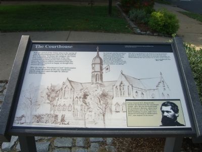
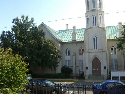
With the arrival of the Union army in the Spring of 1862, Fredericksburg-area slaves by the hundreds fled to freedom. To house the refugees, the Union army transformed the basement of the city courthouse (in front of you) into a temporary barracks. A Union officer remembered that the former slaves “seemed as happy as though they owned the town.”
After the war, the “Freedman’s Court” held session every Friday afternoon in the city courthouse, adjudicating civil cases brought by African-American citizens.
The Federals used the courthouse cupola as a signal station and observation post. From here Union General Darius Couch watched the futile attacks against Marye’s Heights on December 13. Exclaimed Couch, “Oh great God! see how our men, our poor fellows, are falling!”
“The slaves are flocking to the Federal army by hundreds. As many as 80 have gone off at one time from the river plantations, and it is said there is scarcely a slaveholder in Fredericksburg who has not lost one or more of his negroes.”
- Gen. Irvin McDowell, USA, May 5, 1862
Sidebar in lower right corner: Union General O. O. Howard also watched the battle from the courthouse cupola. After the war he would head the Freedman’s Bureau, whose local headquarters were in the Farmer’s Bank building (to your right-rear). Howard University in Washington D.C., was named in his honor.
Erected by National Park Service, U.S. Department of the Interior.
Topics and series. This historical marker is listed in these topic lists: Abolition & Underground RR • African Americans • Notable Buildings • War, US Civil. In addition, it is included in the Historically Black Colleges and Universities series list. A significant historical month for this entry is May 1882.
Location. This marker has been replaced by another marker nearby. It was located near 38° 18.137′ N, 77° 27.594′ W. Marker was in Fredericksburg, Virginia. Marker was at the intersection of Princess Anne Street and George Street on Princess Anne Street. Touch for map. Marker was at or near this postal address: 815 Princess Anne St, Fredericksburg VA 22401, United States of America. Touch for directions.
Other nearby markers. At least 10 other markers are within walking distance of this location. War Comes to Fredericksburg (here, next to this marker); A Sacked and Gutted Town (here, next to this marker); Gen. Stonewall Jackson (a few steps from this marker); A Vast Hospital (a few steps from this marker); The Court House (a few steps from this marker); In Memory of Clara Barton (within shouting distance of this marker); 1910 (within shouting distance of this marker); Great Exodus From Bondage (within shouting distance of this marker); 1833 (within shouting distance of this marker); Corporation Court House (within shouting distance of this marker). Touch for a list and map of all markers in Fredericksburg.
Related marker. Click here for another marker that is related to this marker. This marker has been replaced by the linked marker.
Credits. This page was last revised on February 2, 2023. It was originally submitted on September 18, 2007, by Kevin W. of Stafford, Virginia. This page has been viewed 2,007 times since then and 49 times this year. Photos: 1, 2, 3, 4. submitted on September 18, 2007, by Kevin W. of Stafford, Virginia. • J. J. Prats was the editor who published this page.


