Near Hull Prairie in Wood County, Ohio — The American Midwest (Great Lakes)
Fort Miamis Reserve/Miltonville
Anthony Wayne Parkway
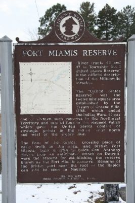
“River tracts 46 and 47 in Township No. 1 United States Reserve” is the official description of the Miltonville location.
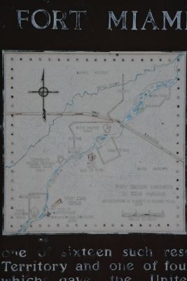
The “United States Reserve” was the twelve mile square area established by the Treaty of Greene Ville, 1795, which ended the Indian Wars. It was one of sixteen such reserves in the Northwest Territory and one of four in the Maumee Valley which gave the United States control of strategic points in the Indian lands north and west of the treaty line.
The Foot of the Rapids, crossing place of early trails in this area, and the British Fort Miamis, built in 1794 to block Gen. Anthony Wayne from an anticipated attack on Detroit, were the reasons for establishing the reserve known as the Fort Miamis Reserve. Remains of the British post near the Foot of the Rapids can still be seen in Maumee.
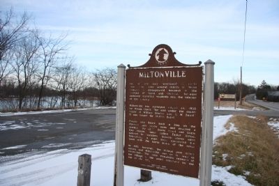
[South side of Marker]:Miltonville
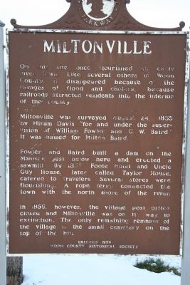
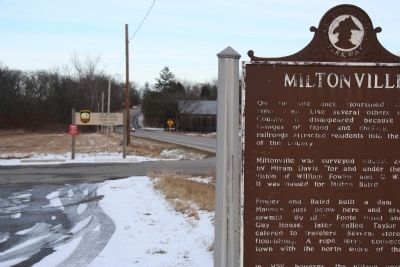
On this site once flourished an early river town. Like several others in Wood County, it disappeared because of the ravages of flood and cholera, because railroads attracted residents into the interior of the county.
Miltonville was surveyed August 24, 1835 by Hiram Davis “for and under the supervision of William Fowler and G. W. Baird.” It was named for Milton Baird.
Fowler and Baird built a dam on the Maumee just below here and erected a sawmill. By 1837, Foote Hotel and Uncle Guy House, later called Taylor House, catered to travelers. Several stores were flourishing. A rope ferry connected the town with the north shore of the river.
In 1859, however, the village post office closed and Miltonville was on its way to extinction. The only remaining remnant of the village is the small cemetery on the top of the hill.
Erected 1959 by Wood County Historical Society.
Topics. This historical marker is listed in these topic lists: Native Americans • Peace • Settlements & Settlers • Wars, US Indian. A significant historical year for this entry is 1795.
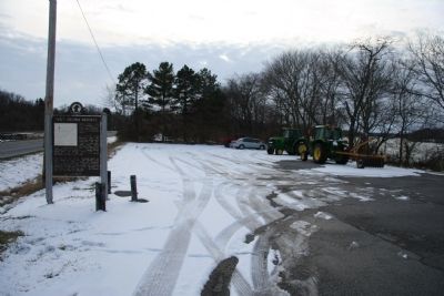
Location. 41° 29.346′ N, 83° 42.87′ W. Marker is near Hull Prairie, Ohio, in Wood County. Marker is on West River Road (Ohio Route 65) 0.3 miles south of Findlay Road (Ohio Route 64), on the right when traveling south. This historical marker is located just south of the Waterville Bridge, on the east side of the Maumee River, at the Miltonville Public Fishing Access. Touch for map. Marker is in this post office area: Bowling Green OH 43402, United States of America. Touch for directions.
Other nearby markers. At least 8 other markers are within walking distance of this marker. The Liberty House (approx. 0.7 miles away); The Columbian House
(approx. 0.7 miles away); Wakeman Hall / Waterville Historical Society (approx. 0.8 miles away); Ohio Electric Railroad Bridge / Roche De Bout, Roche De Boeuf (approx. 0.8 miles away); Waterville Veterans Memorial Flagpole (approx. 0.8 miles away); John Pray - Founder of Waterville,Ohio / The Miami and Erie Canal (approx. 0.8 miles away); Bowling Green Fault (approx. 0.9 miles away); The Oliver Pray House (approx. 0.9 miles away).
Credits. This page was last revised on June 16, 2016. It was originally submitted on December 26, 2009, by Dale K. Benington of Toledo, Ohio. This page has been viewed 1,893 times since then and 41 times this year. Photos: 1, 2, 3, 4, 5, 6. submitted on December 26, 2009, by Dale K. Benington of Toledo, Ohio.
