Marker Logo HMdb.org THE HISTORICAL
MARKER DATABASE
“Bite-Size Bits of Local, National, and Global History”
Raymond in Hinds County, Mississippi — The American South (East South Central)
 

Battle of Raymond


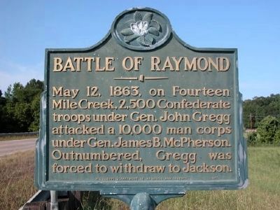
Battle of Raymond Marker image. Click for full size.
Photographed By Karl Stelly
1. Battle of Raymond Marker
Inscription. May 12, 1863, on Fourteen Mile Creek, 2,500 Confederate troops under Gen. John Gregg attacked a 10,000 man corps under Gen. James B. McPherson. Outnumbered, Gregg was forced to withdraw to Jackson.
 
Erected 1971 by The Mississippi Department of Archives and History.
 
Topics and series. This historical marker is listed in this topic list: War, US Civil. In addition, it is included in the Mississippi State Historical Marker Program series list. A significant historical date for this entry is May 12, 1541.
 
Location. 32° 14.409′ N, 90° 26.702′ W. Marker is in Raymond, Mississippi, in Hinds County. Marker is on State Highway 18, 0.2 miles south of Port Gibson Street, on the right when traveling north. Touch for map. Marker is in this post office area: Raymond MS 39154, United States of America. Touch for directions.
 
Other nearby markers. At least 8 other markers are within walking distance of this marker. DeGolyer's Battery and the Artist's Eye (within shouting distance of this marker); U.S. 8th Battery, Michigan Light Artillery (within shouting distance of this marker); King of Battle (within shouting distance of this marker); McPherson's Deployment (within shouting distance of this marker); Eyewitnesses in the Storm (about 400 feet away, measured in a direct line); A "Soldiers' Battle" in the Underbrush
Paid Advertisement
Click on the ad for more information.
Please report objectionable advertising to the Editor.
Click or scan to see
this page online
(about 700 feet away); Texas Memorial (approx. 0.2 miles away); U.S. Battery D, 1st Illinois Light Artillery (approx. 0.2 miles away). Touch for a list and map of all markers in Raymond.
 
Battle of Raymond Marker image. Click for full size.
Photographed By Duane Hall, June 5, 2015
2. Battle of Raymond Marker
View to southwest
View to Northeast Along Highway 18 image. Click for full size.
Photographed By Duane Hall, June 5, 2015
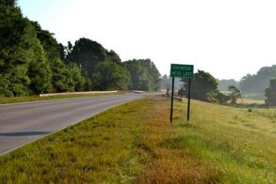
3. View to Northeast Along Highway 18
Marker is on east side of Highway 18 south of Fourteenmile Creek
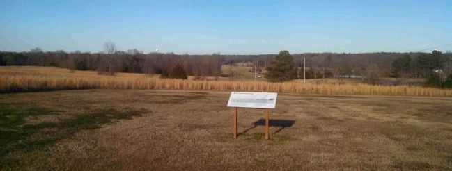
'A Battle Unfolds' Campaign Marker & Surrounding Terrain image. Click for full size.
Photographed By Cleo Robertson, January 24, 2015
4. 'A Battle Unfolds' Campaign Marker & Surrounding Terrain
Located at GPS coordinates N 32° 13.972 W 090° 27.085 slightly off Hwy 18 south of Raymond looking north.
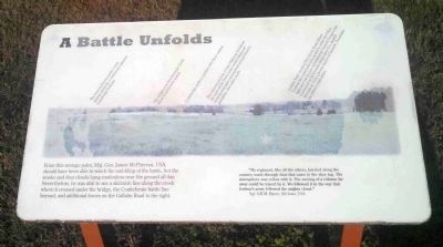
'A Battle Unfolds' Campaign Marker of the Battle of Raymond image. Click for full size.
Photographed By Cleo Robertson, January 24, 2015
5. 'A Battle Unfolds' Campaign Marker of the Battle of Raymond
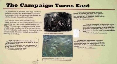
'The Campaign Turns East' Marker Along the Walking Trail image. Click for full size.
Photographed By Cleo Robertson, January 24, 2015
6. 'The Campaign Turns East' Marker Along the Walking Trail
One of the historical campaign markers near and describing major elements of the Battle of Raymond Marker. Located at GPS coordinates 32 14.682 N 90 26.638 W.
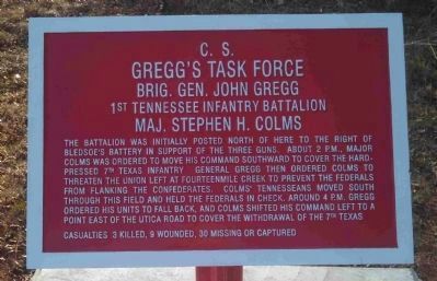
C.S. Gregg's Task Force Marker image. Click for full size.
Photographed By Cleo Robertson, January 24, 2015
7. C.S. Gregg's Task Force Marker
One of the historical battlefield markers along the walking trail describing and expanding on the Battle of Raymond. It is located at GPS coordinates 32 14.672 N 90 26.617 W.
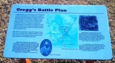
Gregg's Battle Plan Campaign Marker image. Click for full size.
Photographed By Cleo Robertson, January 24, 2015
8. Gregg's Battle Plan Campaign Marker
One of the historical battlefield markers along the walking trail describing an important portion of the Battle of Raymond.
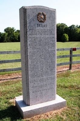
Texas State Memorial, Battle of Raymond image. Click for full size.
Photographed By Karl Stelly
9. Texas State Memorial, Battle of Raymond
The State of Texas erected this memorial in 2002 to honor its sons who fought here at the Battle of Raymond on May 12, 1863. This is one of only about 20 such memorials erected by the State of Texas to commemorate their troops engaged in Civil War battles at a number of important locations.
 
 
Credits. This page was last revised on October 2, 2020. It was originally submitted on January 2, 2010, by Karl Stelly of Gettysburg, Pennsylvania. This page has been viewed 1,956 times since then and 27 times this year. Photos:   1. submitted on January 2, 2010, by Karl Stelly of Gettysburg, Pennsylvania.   2, 3. submitted on June 12, 2015, by Duane Hall of Abilene, Texas.   4, 5, 6, 7. submitted on February 6, 2015, by Cleo Robertson of Fort Lauderdale, Florida.   8. submitted on February 7, 2015, by Cleo Robertson of Fort Lauderdale, Florida.   9. submitted on January 2, 2010, by Karl Stelly of Gettysburg, Pennsylvania. • Craig Swain was the editor who published this page.
Share this page.  
Share on Tumblr
m=26145

CeraNet Cloud Computing sponsors the Historical Marker Database.
This website earns income from purchases you make after using our links to Amazon.com. We appreciate your support.
Paid Advertisement
Apr. 16, 2024