Grays in Jasper County, South Carolina — The American South (South Atlantic)
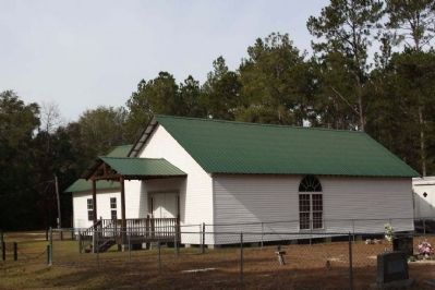
Oak Grove Baptist Church
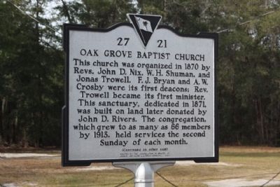
This church was organized in 1870 by Revs. John D. Nix, W.H. Shuman, and Jonas Trowell. F.J. Bryan and A.W. Crosby were its first deacons; Rev. Trowell became its first minister. This sanctuary, dedicated in 1871, was built on land later donated by John D. Rivers. The congregation, which grew to as many as 66 members by 1913, held services the second Sunday of each month.
(Reverse text)
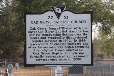
Oak Grove, long affiliated with the Savannah River Baptist Association, saw its membership decline over the years and eventually discontinued regular services in 1942. In 1989 descendants of charter members and other former members began restoring the original frame sanctuary. Oak Grove Baptist Church was formally reorganized and resumed services once more in 2000.
Erected 2003 by The Congregation in Memory of George and Elise Malphrus Roberts. (Marker Number 27-21.)
Topics. This historical marker is listed in this topic list: Churches & Religion. A significant historical year for this entry is 1870.
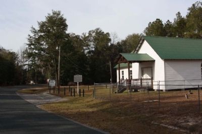
Location. 32° 40.254′ N, 81° 4.321′ W. Marker is in Grays, South Carolina, in Jasper County. Marker is on Rivers Hill Road (State Highway 27-17) near State Highway 27-41, on the right when traveling east. Touch for map. Marker is in this post office area: Pineland SC 29934, United States of America. Touch for directions.
Other nearby markers. At least 8 other markers are within 11 miles of this marker, measured as the crow flies. Grays Consolidated High School (approx. 3 miles away); Pine Level Baptist Church (approx. 3.3 miles away); Gillisonville (approx. 6 miles away); Gillisonville Baptist Church (approx. 6.1 miles away); Robertville (approx. 9.4 miles away); Coosawhatchie (approx. 10.1 miles away); Battle of Coosawhatchie (approx. 10.2 miles away); Battle at the Tulifinny Crossroads (approx. 10.8 miles away).
Credits. This page was last revised on June 16, 2016. It was originally submitted on January 3, 2010, by Mike Stroud of Bluffton, South Carolina. This page has been viewed 1,732 times since then and 26 times this year. Photos: 1, 2, 3, 4, 5. submitted on January 3, 2010, by Mike Stroud of Bluffton, South Carolina. • Craig Swain was the editor who published this page.
