Urca in Rio de Janeiro, Brazil — Southeast Region (Coastal)
CCAPA
Companhia Camaniho Aéreo Pão de Açúcar
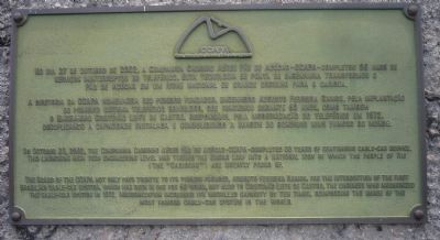
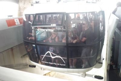
No dia 27 de Octubro de 2002, a Companhia Camaniho Aéreo Pão de Açúcar - CCAPA - compleou 90 anos de serviços ininteruptos do teleférico. Esta tecnologia de ponta de engemharia transformou o Pão de Açucar em um icone nacional de grande orgulho par o carioca.
A diretoria da CCAPA homenageia seu pioneiro fundador, engenheiro Augusto Ferreira Ramos, pela implantação do primeiro sistema teleferico Brasileiro, que funcionou durante 60 anos, como também o Engenheiro Cristóvão Leite de Castro, responsável pela modernizção do teleférico em 1972 decuplicando a capacidade instalada e consolidando a imagem do bondinho mais famoso do mundo.
On October 27, 2002, the Companhia Camaniho Aéreo Pão de Açúcar - CCAPA - completed 90 years of continuous cable-car service. This launching high tech engineering level has turned the Sugar Loaf into a national icon of which the people (The “Cariocas”) are greatly proud of.
The Board of the CCAPA not only pays tribute to its pioneer founder, Augusto Ferreira Ramos, for the introduction of the first Brasilian cable-car system, which has been in use for 60 years, but also to Cristovão Leite de Castro, the engineer who modernized the cable-car system in 1972. Modernization increased its installed capacity by ten times, reinforcing the image of the most famous cable-car system in the world.
Erected 2002 by Companhia Camaniho Aéreo Pão de Açúcar - CCAPA.
Topics. This historical marker is listed in these topic lists: Air & Space • Man-Made Features • Railroads & Streetcars. A significant historical month for this entry is October 1976.
Location. 22° 56.932′ S, 43° 9.407′ W. Marker is in Rio de Janeiro. It is in Urca. Marker can be reached from the intersection of Alameda Tenente Antonio João and Pão de Açúca station. Touch for map. Marker is at or near this postal address: Alameda Ten Antonio João 4, Rio de Janeiro 22291-150, Brazil. Touch for directions.
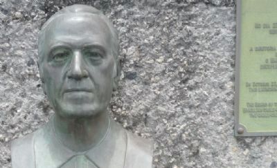
Other nearby markers. At least 8 other markers are within 6 kilometers of this marker, measured as the crow flies. Cristovão Leite de Castro (here, next to this marker); Augusto Ferreira Ramos (approx. 0.9 kilometers away); Christ the Redeemer Monument (approx. 4.4 kilometers away); Copacabana Fort (approx. 5.3 kilometers away); APA das Pontas de Copacabana e Arpoador (approx. 5.3 kilometers away); Praça 15 de Novembro (approx. 5.4 kilometers away); Ordem Terceira do Carmo Church (approx. 5.4 kilometers away); João Cândido Felisberto Memorial (approx. 5.5 kilometers away). Touch for a list and map of all markers in Rio de Janeiro.
Additional keywords. Aerial tramway; tourism; Urca Mountain; Morro da Urca
Credits. This page was last revised on January 31, 2023. It was originally submitted on January 11, 2010, by Richard E. Miller of Oxon Hill, Maryland. This page has been viewed 2,808 times since then and 14 times this year. Photos: 1, 2, 3, 4, 5, 6. submitted on January 11, 2010, by Richard E. Miller of Oxon Hill, Maryland. 7. submitted on January 12, 2010, by Richard E. Miller of Oxon Hill, Maryland. • Kevin W. was the editor who published this page.
