Kells in County Meath, Leinster, Ireland — Mid-East (and Dublin)
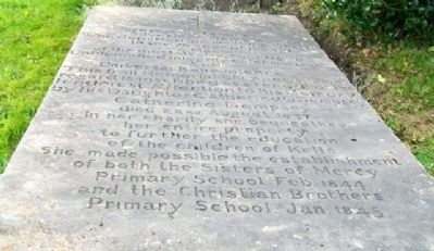
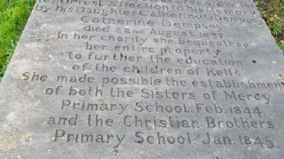
Catherine Dempsey
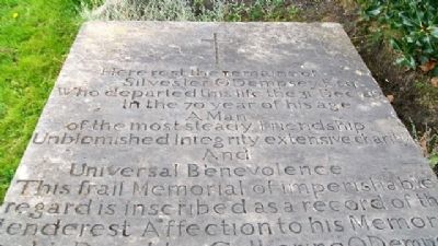
Silvester O'Dempsey Esq.
Who departed this life the 31 Dec. 1817
In the 70 year of his age
A Man
of the most steady Friendship
Unblemished Integrity extensive charity
And
Universal Benevolence
This frail Memorial of imperishable
regard is inscribed as a record of the
tenderest Affection to his Memory
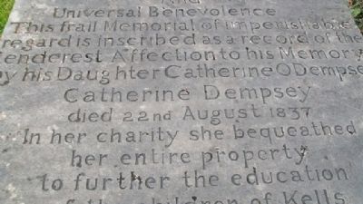
by his Daughter Catherine ODempsey
Catherine Dempsey
died 22nd August 1837
In her charity she bequeathed
her entire property
to further the education
of the children of Kells
She made possible the establishment
of both the Sisters of Mercy
Primary School Feb. 1844
and the Christian Brothers
Primary School, Jan. 1845
Topics. This historical marker is listed in these topic lists: Cemeteries & Burial Sites • Charity & Public Work • Education • Women. A significant historical year for this entry is 1817.
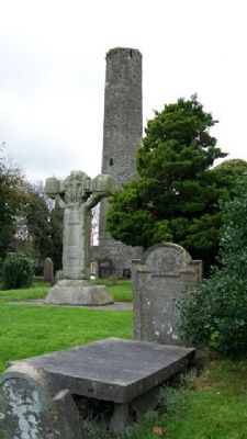
Location. 53° 43.655′ N, 6° 52.838′ W. Marker is in Kells, Leinster, in County Meath. Grave marker is located in the St Columba's Church yard, only meters east of the Unfinished High Cross, with church grounds entrance off Cannon Street (Regional Road 163). Touch for map. Touch for directions.
Other nearby markers. At least 8 other markers are within 2 kilometers of this marker, measured as the crow flies. Kells Round Tower (within shouting distance of this marker); The Churchyard Wall (about 90 meters away, measured in a direct line); Suffolk Street (about 90 meters away); St Columba's Church (about 120 meters away); Headfort Place (approx. 0.6 kilometers away); Kells Courthouse (approx. 0.6 kilometers away); Market Cross (approx. 0.6 kilometers away); Spire of Loyd (approx. 1.7 kilometers away). Touch for a list and map of all markers in Kells.
Credits. This page was last revised on October 23, 2019. It was originally submitted on January 13, 2010, by William Fischer, Jr. of Scranton, Pennsylvania. This page has been viewed 1,675 times since then and 14 times this year. Photos: 1, 2, 3, 4, 5. submitted on January 13, 2010.
