Marathon in Brewster County, Texas — The American South (West South Central)
Marathon
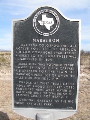
Marathon was founded in 1881. Named by an old sea captain, A.E. Shepard, for the Plain of Marathon, in Greece, of which the hills here reminded him.
Cradle of West Texas cattle industry. Among the first noted ranchers here were Mayer M. Halff and brother, owners of the famous Circle Dot brand.
Original gateway to the Big Bend National Park.
Erected 1965 by State Historical Survey Committee. (Marker Number 3201.)
Topics and series. This historical marker is listed in these topic lists: Forts and Castles • Native Americans • Settlements & Settlers. In addition, it is included in the Comanche Trail into Mexico series list. A significant historical year for this entry is 1879.
Location. 30° 12.377′ N, 103° 13.724′ W. Marker is in Marathon, Texas, in Brewster County. Marker is on U.S. 90. Touch for map. Marker is in this post office area: Marathon TX 79842, United States of America. Touch for directions.
Other nearby markers. At least 7 other markers are within 10 miles of this marker, measured as the crow flies. First School House (approx. 0.9 miles away); Albion E. Shepard House (approx. one mile away); Chambers Hotel (approx. one mile away); The Gage Hotel (approx. one mile away); Colonel Lewis Given Harman (approx. 1.8 miles away); Fort Peña Colorado (Red Rock) (approx. 5.1 miles away); Los Caballos (approx. 10 miles away).
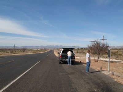
More about this marker. Marker is about 1 mi. east of town on US 90.
Credits. This page was last revised on September 18, 2019. It was originally submitted on January 14, 2010, by Richard Denney of Austin, Texas. This page has been viewed 1,636 times since then and 155 times this year. Photos: 1, 2, 3, 4. submitted on January 14, 2010, by Richard Denney of Austin, Texas. • Bill Pfingsten was the editor who published this page.


