Farrelly Pond District in San Leandro in Alameda County, California — The American West (Pacific Coastal)
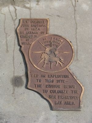
De Anza Expedition 1775 - 1776
In the center of the marker is a circular motif, designed by Doris Birkland Beezley, of a rider superimposed upon a sun-like set of compass points, with the "De Anza Expedition 1775 1776" written above the rider.
Topics and series. This historical marker is listed in these topic lists: Colonial Era • Exploration • Hispanic Americans. In addition, it is included in the Juan Bautista de Anza National Historic Trail series list. A significant historical year for this entry is 1775.
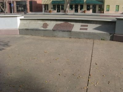
Location. 37° 43.63′ N, 122° 9.475′ W. Marker is in San Leandro, California, in Alameda County. It is in the Farrelly Pond District. Marker can be reached from East 14th Street (State Highway 185) near Toler Avenue. Marker is located at the City of San Leandro - Root Park. Touch for map. Marker is in this post office area: San Leandro CA 94577, United States of America. Touch for directions.
Other nearby markers. At least 8 other markers are within walking distance of this marker. Rancho San Antonio (here, next to this marker); The Little Brown Church (approx. 0.2 miles away); San Leandro Courthouse Site (approx. 0.2 miles away); County Courthouse (approx. 0.2 miles away); Historic Best Building (approx. 0.2 miles away); Casa Peralta (approx. 0.2 miles away); San Leandro – Cherry Festivals (approx. ¼ mile away); Historic Daniel & Meta Best Home (approx. ¼ mile away). Touch for a list and map of all markers in San Leandro.
Also see . . .
1. A KTEH TV Production of the DeAnza Trail on YouTube. In this video one learns the history and purpose of the DeAnza Expedition, the heritage of descendants of expedition members, and current sites along the trail. (Submitted on January 14, 2010, by Syd Whittle of Mesa, Arizona.)
2. Juan Bautista de Anza - Blazed the Anza Trail. Juan Bautista de Anza was the first European to establish an overland route from Mexico, through the Sonoran Desert, to the Pacific coast of California. New World Spanish explorers had been seeking such a route through the Desert Southwest for more than two centuries. (Submitted on January 14, 2010, by Syd Whittle of Mesa, Arizona.)

Photographed By Syd Whittle, January 10, 2010
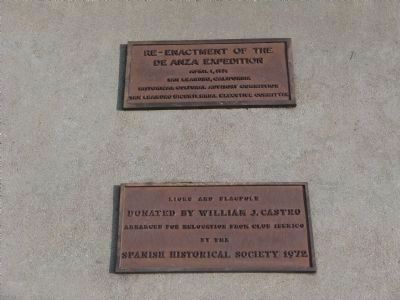
3. De Anza Expedition Re-Inactment Dedication Plaques
Upper Plaque:Re-Enactment of the
de Anza Expedition
April 1, 1976
San Leandro, California
Historical Cultural Advisory Commission
San Leandro Bicentennial Executive Committee
Lower Plaque:
Lions and Flagpole
Donated by William J. Castro
Arranged for relocation from Club Iberico
by the
Spanish Historical Society, 1972
de Anza Expedition
April 1, 1976
San Leandro, California
Historical Cultural Advisory Commission
San Leandro Bicentennial Executive Committee
Donated by William J. Castro
Arranged for relocation from Club Iberico
by the
Spanish Historical Society, 1972

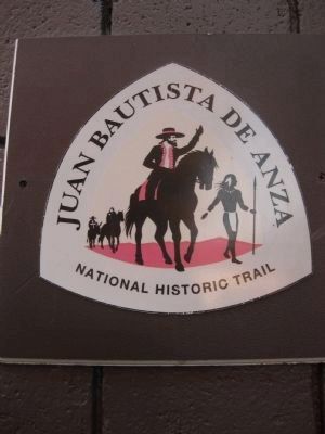
4. Juan Batista de Anza National Historic Trail Sign
Per the National Park Service trail guide: "The Juan Bautista de Anza National Historic Trail is a 1,210-mile historic route from Nogales, Arizona to San Francisco, California. The trail commemorates the story of the 1775-1776 Spanish Expedition whose members, consisting of some 30 families, experienced this overland route on their trek to Alta (or upper) California. They founded and established the Mission and Presidio of San Francisco, the Mission in Santa Clara and the Pueblo of San José. Most settled in what is today the San Francisco Bay Area."
Credits. This page was last revised on February 7, 2023. It was originally submitted on January 14, 2010, by Syd Whittle of Mesa, Arizona. This page has been viewed 1,790 times since then and 16 times this year. Photos: 1, 2, 3. submitted on January 14, 2010, by Syd Whittle of Mesa, Arizona. 4. submitted on November 22, 2009.

