Near Winchester in Frederick County, Virginia — The American South (Mid-Atlantic)
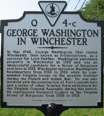
George Washington in Winchester
Erected 2005 by Department of Historic Resources. (Marker Number Q 4c.)
Topics and series. This historical marker is listed in this topic list: Colonial Era. In addition, it is included in the Former U.S. Presidents: #01 George Washington, the George Washington Slept Here, and the Virginia Department of Historic Resources (DHR) series lists. A significant historical month for this entry is March 1748.
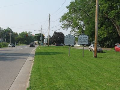
Location. 39° 12.1′ N, 78° 9.31′ W. Marker is near Winchester, Virginia, in Frederick County. Marker is at the intersection of Martinsburg Pike (U.S. 11) and Brooke Road (Local Route 1322), on the right when traveling south on Martinsburg Pike. Touch for map. Marker is at or near this postal address: 922 Martinsburg Pike, Winchester VA 22603, United States of America. Touch for directions.
Other nearby markers. At least 10 other markers are within walking distance of this marker. Fort Collier (here, next to this marker); a different marker also named Fort Collier (within shouting distance of this marker); 2nd Battle of Winchester / 3rd Battle of Winchester (about 300 feet away, measured in a direct line); 2nd Battle of Winchester (about 300 feet away); 3rd Battle of Winchester (about 300 feet away); Lt. Collier’s Earthworks (about 300 feet away); a different marker also named Fort Collier (about 500 feet away); The Cavalry Charge at Fort Collier (about 600 feet away); Third Battle of Winchester (about 600 feet away); Second Battle of Winchester (approx. half a mile away). Touch for a list and map of all markers in Winchester.
More about this marker. This marker replaced a marker with this same title and number erected in the late 1920s or early 1930s that read on the front, “George Washington began his career here in 1748 as surveyor to Lord Fairfax. Here he had his headquarters as commander on the Virginia frontier against the French and Indians, 1755-1758. Here he built Fort Loudoun, and was a member of the House of Burgesses for this county, 1758–1761.” On the
back was, “Winchester — At first called Fredericktown, it was founded in 1744, near a Shawnee Indian village, by Colonel James Wood, a native of the English city of Winchester. The town was situated in Lord Fairfax’s proprietary of the Northern Neck. It was chartered in 1752.”
Regarding George Washington in Winchester. Separate historical markers detail George Washington’s Lot, his office, and Fort Loudoun.
Related markers. Click here for a list of markers that are related to this marker. To better understand the relationship, study each marker in the order shown.
Credits. This page was last revised on November 7, 2020. It was originally submitted on September 3, 2007, by Craig Swain of Leesburg, Virginia. This page has been viewed 2,701 times since then and 70 times this year. Last updated on September 23, 2007, by Craig Swain of Leesburg, Virginia. Photos: 1, 2, 3, 4. submitted on September 3, 2007, by Craig Swain of Leesburg, Virginia. • J. J. Prats was the editor who published this page.


