Smithfield in Isle of Wight County, Virginia — The American South (Mid-Atlantic)
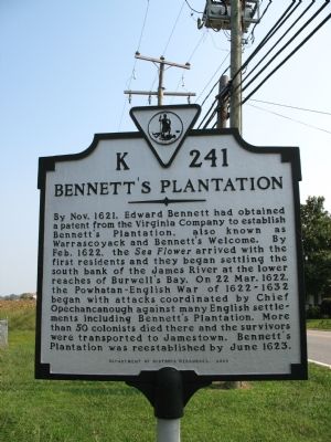
Bennett’s Plantation
Erected 2000 by Department of Historic Resources. (Marker Number K-241.)
Topics and series. This historical marker is listed in this topic list: Colonial Era. In addition, it is included in the Virginia Department of Historic Resources (DHR) series list. A significant historical month for this entry is June 1623.
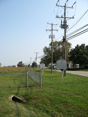
Location. 37° 0.832′ N, 76° 38.053′ W. Marker is in Smithfield, Virginia, in Isle of Wight County. Marker is on Old Stage Highway (Virginia Route 10) north of Blounts Corner Road, on the right when traveling north. This marker also sits with K-242 before Hardy Elementary School. Touch for map. Marker is in this post office area: Smithfield VA 23430, United States of America. Touch for directions.
Other nearby markers. At least 8 other markers are within 2 miles of this marker, measured as the crow flies. Basse’s Choice (here, next to this marker); Welcome to Fort Boykin Historic Park (approx. 1.6 miles away); Welcome to Fort Boykin (approx. 1.7 miles away); Fort Boykin (approx. 1.7 miles away); The Historic James and its Tributaries (approx. 1.7 miles away); Camp Eustis Attacks Fort Boykin (approx. 1.7 miles away); Fort Boykin Memorial (approx. 1.7 miles away); Fort Boykin during the Civil War (approx. 1.7 miles away). Touch for a list and map of all markers in Smithfield.
Credits. This page was last revised on June 16, 2016. It was originally submitted on September 23, 2007, by Laura Troy of Burke, Virginia. This page has been viewed 4,912 times since then and 318 times this year. Photos: 1, 2. submitted on September 23, 2007, by Laura Troy of Burke, Virginia. • J. J. Prats was the editor who published this page.

