Near Surry in Surry County, Virginia — The American South (Mid-Atlantic)
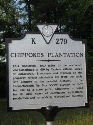
Chippokes Plantation
Erected 1989 by Department of Conservation and Historic Resources. (Marker Number K-279.)
Topics and series. This historical marker is listed in these topic lists: Colonial Era • Notable Buildings • Settlements & Settlers. In addition, it is included in the Virginia Department of Historic Resources (DHR) series list. A significant historical year for this entry is 1619.
Location. 37° 7.77′ N, 76° 48.336′ W. Marker is near Surry, Virginia, in Surry County. Marker is at the intersection of Alliance Road and Colonial Trail East (Virginia Route 10), on the right when traveling north on Alliance Road. Touch for map. Marker is in this post office area: Surry VA 23883, United States of America. Touch for directions.
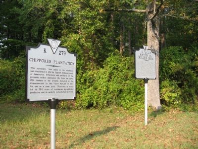
Other nearby markers. At least 8 other markers are within 2 miles of this marker, measured as the crow flies. History on Crouch’s Creek (here, next to this marker); Pleasant Point (about 300 feet away, measured in a direct line); Surry County WWII Veterans Memorial (approx. 1.7 miles away); Capt. Jacob Faulcon, C.S.A. (approx. 1.7 miles away); Surry County Confederate Monument (approx. 1.7 miles away); Smith’s Fort Plantation (approx. 1.7 miles away); Surry County War Memorial (approx. 1.7 miles away); Chanco (approx. 1.7 miles away). Touch for a list and map of all markers in Surry.
More about this marker. This marker also sits with K-234.
Credits. This page was last revised on June 16, 2016. It was originally submitted on September 23, 2007, by Laura Troy of Burke, Virginia. This page has been viewed 1,618 times since then and 23 times this year. Photos: 1, 2. submitted on September 23, 2007, by Laura Troy of Burke, Virginia. • J. J. Prats was the editor who published this page.

