Washington Township near Morrow in Warren County, Ohio — The American Midwest (Great Lakes)
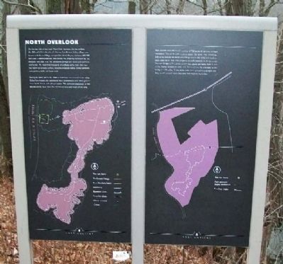
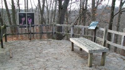
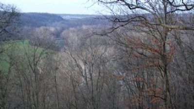
North Overlook
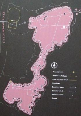
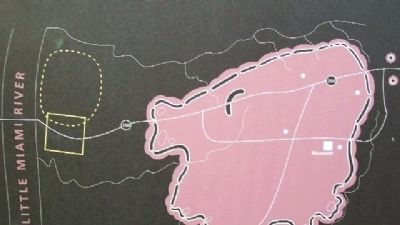
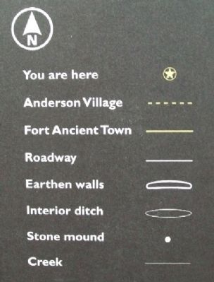
On the east side of the Little Miami River between the two bridges (Rt. 350 and I-71) is the site of a former Fort Ancient Indian village, now known as Anderson Village, occupied for about 20 years between AD 1000 and 1200. Clifford Anderson, who owned this property, excavated the site between 1893 and 1936. He uncovered garbage pits, house post patterns, and burials. He recovered thousands of artifacts, some more than four feet below the present surface, indlucing projectile points, knives, hammers, axes, pottery, shells, and bone tools.
During the latter half of the 1800s a small town was located in the valley. Called Fort Ancient, this community had a schoolhouse, post office, general store, hotel, church, and railroad station. The estimated population of 300 abandoned the town after the 1913 flood destroyed much of the area.
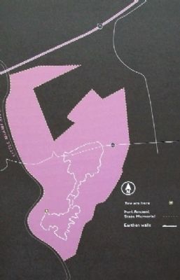
Fort Ancient State Memorial consists of 768 acres, 85 percent of them woodland. The earth walls enclose about 126 acres. The remaining 642 acres include the Anderson Village site in the valley and land on both sides of Rt. 350. The property actually extends to the Jeremiah Morrow Bridge (I-71), which, at 275 feet above the valley floor, is one of the highest bridges in Ohio. The distance from the overlook to the bridge is 1.75 miles. If the earth walls were placed in a straight line, they would extend more than one mile beyond the bridge.
Erected by The Ohio Historical Society.
Topics. This historical marker is listed in these topic lists: Exploration • Forts and Castles • Man-Made Features • Native Americans • Natural Features • Settlements & Settlers.
Location. 39° 24.021′ N, 84° 5.876′ W. Marker is near Morrow, Ohio, in Warren County. It is in Washington Township. Marker is at the South Fort's North Overlook in Fort Ancient State Memorial. Touch for map. Marker is at or near this postal address: 6123 Ohio Route 350, Oregonia OH 45054, United States of America. Touch for directions.
Other nearby markers. At least 8 other markers are within walking distance of this marker. Hilltop Enclosure (here, next to this marker); Fort Ancient Prehistoric Indian Earthworks (a few steps from this marker); Fort Ancient Dwelling (about 300 feet away, measured in a direct line); The Myth of the Mound Builders (about 300 feet away); The Great Gateway (approx. 0.2 miles away); Fort Ancient Earthworks (approx. 0.2 miles away); Changes at Fort Ancient (approx. 0.2 miles away); Earthworks Trail (approx. ¼ mile away). Touch for a list and map of all markers in Morrow.
Also see . . .
1. Fort Ancient Earthworks. Ohio History Central website entry
(Submitted on January 25, 2010, by William Fischer, Jr. of Scranton, Pennsylvania.)
2. Fort Ancient State Memorial. Ohio State Parks website entry (Submitted on July 24, 2022, by Larry Gertner of New York, New York.)
Credits. This page was last revised on February 6, 2023. It was originally submitted on January 25, 2010, by William Fischer, Jr. of Scranton, Pennsylvania. This page has been viewed 800 times since then and 11 times this year. Photos: 1, 2, 3, 4, 5, 6, 7. submitted on January 25, 2010, by William Fischer, Jr. of Scranton, Pennsylvania.
