Tres Pinos in San Benito County, California — The American West (Pacific Coastal)
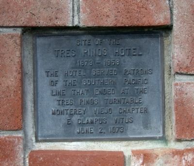
Site of the Tres Pinos Hotel
1873-1958
of the Southern Pacific
line that ended at the
Tres Pinos turntable.
Monterey Viejo Chapter
E Clampus Vitus
June 2, 1973
Erected 1973 by Monterey Viejo Chapter of E Clampus Vitus.
Topics and series. This historical marker is listed in these topic lists: Notable Buildings • Railroads & Streetcars. In addition, it is included in the E Clampus Vitus series list. A significant historical month for this entry is June 1799.
Location. 36° 47.441′ N, 121° 19.334′ W. Marker is in Tres Pinos, California, in San Benito County. Marker is at the intersection of California Route 25 and Fifth Street, on the right when traveling north on State Route 25. Touch for map. Marker is in this post office area: Tres Pinos CA 95075, United States of America. Touch for directions.
Other nearby markers. At least 8 other markers are within 5 miles of this marker, measured as the crow flies. 19th Hole Rendezvous (approx. ¼ mile away); San Benito County Historical Park (approx. 1.4 miles away); Cottage Corners (approx. 1½ miles away); Palmtag Cutting Shed (approx. 1½ miles away); Vineyard School (approx. 4.7 miles away); New Idria Mine (approx. 4.9 miles away); Tres Pinos/Paicines (approx. 4.9 miles away); The Downfall of Tiburcio Vasquez (approx. 4.9 miles away). Touch for a list and map of all markers in Tres Pinos.
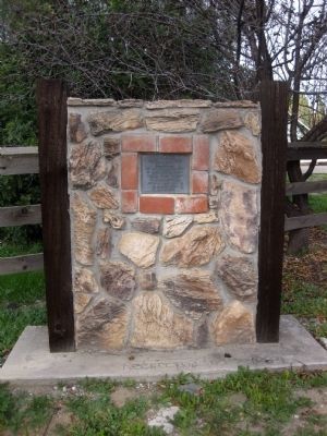
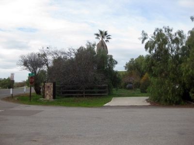
More about this marker. The marker is mounted on a monument at the corner of State Highway 25 (Airline Highway) and Fifth Street that is more easily seen when heading north (i.e. towards Hollister).
Regarding Site of the Tres Pinos Hotel. From A Memorial and Biographical History of the Coast Counties of Central California, by Barrows and Ingersoll (1893): "Tres Pinos (Three Pines) is a thriving town eight miles south of Hollister, and the terminus of the San Benito branch of the Southern Pacific railway, which was extended to that point in 1873. This is the shipping point for an extensive, and very productive region. Large quantities of grain, hay, dairy products, poultry, wool, hides, etc., are annually brought to the Tres Pinos station to be sent to market by rail."
In 1944, Southern Pacific stopped running trains to Tres Pinos and dismantled the train station.
Credits. This page was last revised on June 16, 2016. It was originally submitted on January 27, 2010, by Andrew Ruppenstein of Lamorinda, California. This page has been viewed 1,451 times since then and 48 times this year. Photos: 1, 2, 3. submitted on January 27, 2010, by Andrew Ruppenstein of Lamorinda, California. • Syd Whittle was the editor who published this page.


