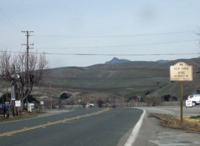
Paicines in San Benito County, California — The American West (Pacific Coastal)
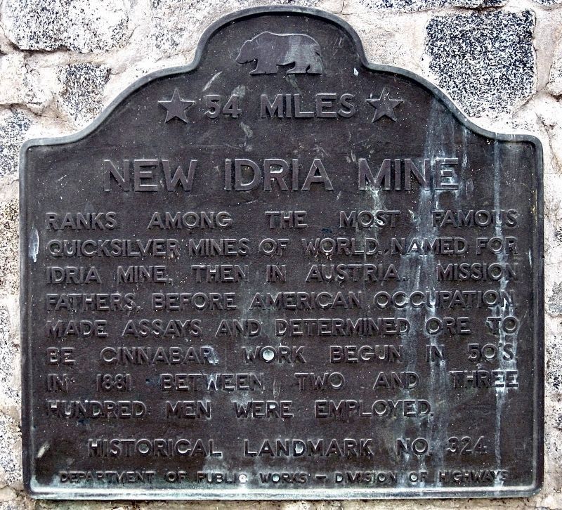
New Idria Mine
54 Miles
Erected by California Department of Public Works - Division of Highways. (Marker Number 324.)
Topics and series. This historical marker is listed in this topic list: Industry & Commerce. In addition, it is included in the California Historical Landmarks series list. A significant historical year for this entry is 1881.
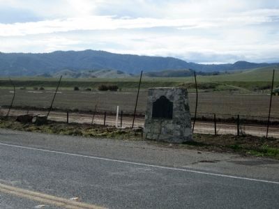
Location. 36° 43.749′ N, 121° 16.743′ W. Marker is in Paicines, California, in San Benito County. Marker is at the intersection of State Highway 25 and Panoche Road, on the right when traveling south on State Highway 25. Touch for map. Marker is in this post office area: Paicines CA 95043, United States of America. Touch for directions.
Other nearby markers. At least 8 other markers are within 5 miles of this marker, measured as the crow flies. Tres Pinos/Paicines (about 300 feet away, measured in a direct line); The Downfall of Tiburcio Vasquez (about 300 feet away); Limekiln Monorail (approx. 2.9 miles away); Palmtag Cutting Shed (approx. 3.4 miles away); Cottage Corners (approx. 3.4 miles away); San Benito County Historical Park (approx. 3½ miles away); 19th Hole Rendezvous (approx. 4.7 miles away); Site of the Tres Pinos Hotel (approx. 4.9 miles away). Touch for a list and map of all markers in Paicines.
Regarding New Idria Mine. The settlement of New Idria is now a ghost town.
Also see . . . Idria (from the October 2005 Three Rocks Report). "The discovery of rich cinnabar deposits in the southern Diablo Mountains in 1853 lead to the development of the worlds fourth largest quicksilver mine. The claim was filed for 'New Idria' by Henry F. Pitts, Rafael Ripa, José Dolores Molina, and William Norrlin on March 20, 1854 and the town of New Idria quickly sprung up on the northeastern slope of San Carlos Peak. The town's name honors the world's second largest quicksilver mine, the Idrija Mine located in what is now Slovenia. Other mines, such as the Aurora, Alpine, Clear Creek, Picacho and Fourth of July mines soon opened and the area became quickly became a bustling community as miners, ranchers and farmers began moving in the area.
California quicksilver mining became very profitable during the 1850s because mercury was needed for extracting gold from the ore during the California gold rush and the discovery of the New Almaden and New Idria mines freed American's gold industry from European control, which dominated the world production previous to 1850."
See www.new-idria.org for an extensive description of New Idria, its history, and the surrounding area. (Submitted on January 30, 2010.)
Additional commentary.
1. Idra Mine
I used to live in Idra as a child around 1966. It was the first home I remember. My father was a miner there and still owns a company yearbook. I also went to school there. The school was run by nuns first, and then by regular teachers. I believe my teacher's name was Mr. Briggs. Idra was just another small town then but still my home. I have fond memories of Christmas, school plays
in which played a tree. Lots of families, and oh yeah, who could forget the tarantulas!
— Submitted January 17, 2012, by Richard G Hardesty of Lufkin, Texas.
Additional keywords. Mercury
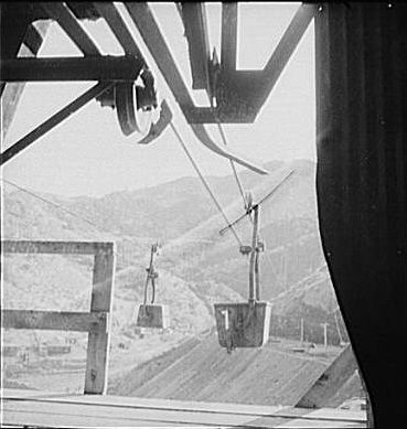
Photographed By Andreas Feininger, December 1942
4. New Idria Mine - Ore Tramway
"Production. Mercury. Aerial tramway which carries mercury ore from mines at New Idria, California to a nearby extraction plant. Triple-distilled mercury is produced here by the New Idria Quicksilver Mining Company..."
In December 1942, Andreas Feininger documented the workings of the New Idria Mine for the US Farm Security Administration. Shortly thereafter he became a staff photographer for Life Magazine, shooting for them for nearly 20 years.
In December 1942, Andreas Feininger documented the workings of the New Idria Mine for the US Farm Security Administration. Shortly thereafter he became a staff photographer for Life Magazine, shooting for them for nearly 20 years.
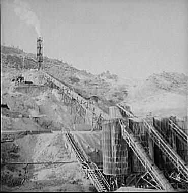
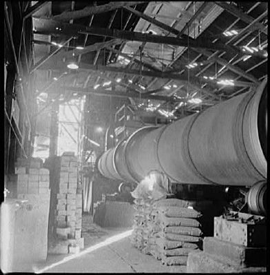
Photographed By Andreas Feininger, December 1942
5. New Idria Mine - Mercury Extraction Plant
"Production. Mercury. A mercury extraction plant at New Idria, California. Triple-distilled mercury is produced here by the New Idria Quicksilver Mining Company from cinnabar, an ore containing sulphur and mercury mined at a number of workings near the plant"
Credits. This page was last revised on March 10, 2022. It was originally submitted on January 29, 2010. This page has been viewed 2,642 times since then and 59 times this year. Last updated on September 7, 2020. Photos: 1. submitted on October 4, 2021, by Craig Baker of Sylmar, California. 2, 3. submitted on January 29, 2010, by Andrew Ruppenstein of Lamorinda, California. 4, 5, 6. submitted on January 30, 2010, by Andrew Ruppenstein of Lamorinda, California. 7. submitted on January 29, 2010, by Andrew Ruppenstein of Lamorinda, California. • J. Makali Bruton was the editor who published this page.
