Near Butler in Taylor County, Georgia — The American South (South Atlantic)
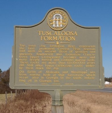
Tuscaloosa Formation
Oil fields of Alabama and Mississippi are from marine beds of this formation, which occur also in Georgia to the south, indicating oil in Georgia too.
Erected 1953 by Georgia Historical Commission. (Marker Number 133-1.)
Topics and series. This historical marker is listed in this topic list: Natural Features. In addition, it is included in the Georgia Historical Society series list.
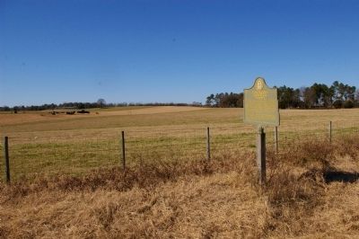
Location. 32° 37.899′ N, 84° 15.173′ W. Marker is near Butler, Georgia, in Taylor County. Marker is on U.S. 19, 0.1 miles south of Jack Peed Road, on the right when traveling south. Touch for map. Marker is in this post office area: Butler GA 31006, United States of America. Touch for directions.
Other nearby markers. At least 8 other markers are within 8 miles of this marker, measured as the crow flies. William Bartram Trail (approx. 4.7 miles away); The Wire Road (approx. 4.9 miles away); The Montgomery Hospital (approx. 5.1 miles away); Taylor County (approx. 5.2 miles away); Confederate Memorial (approx. 5.2 miles away); Taylor County War Memorial (approx. 5.2 miles away); Taylor County Rural Electric Cooperative (approx. 6.4 miles away); Old Federal Road (approx. 7.4 miles away). Touch for a list and map of all markers in Butler.
Credits. This page was last revised on June 16, 2016. It was originally submitted on February 4, 2010, by David Seibert of Sandy Springs, Georgia. This page has been viewed 1,471 times since then and 39 times this year. Photos: 1, 2, 3. submitted on February 4, 2010, by David Seibert of Sandy Springs, Georgia. • Craig Swain was the editor who published this page.


