Washington Township near Morrow in Warren County, Ohio — The American Midwest (Great Lakes)
Stages of Construction / Crescent Mounds
Inscription.
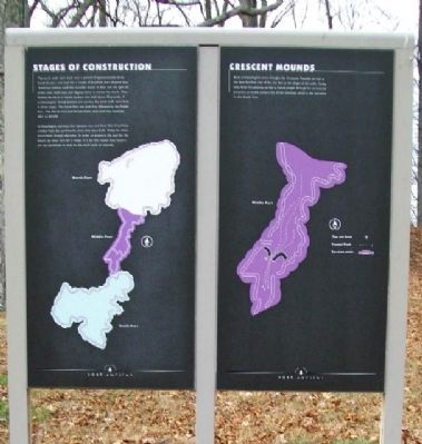
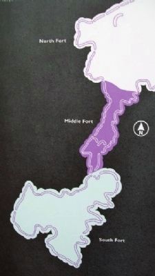
Stages of Construction
The earth walls were built over a period of approximately three hundred years and used for a couple of hundred years beyond that. American Indians used the shoulder bones of deer and elk, split elk antler, clam shell hoes, and digging sticks to loosen the earth. They moved the earth in woven baskets that held about 40 pounds. If archaeologists' interpretations are correct, the earth walls were built in three stages. The South Fort was built first, followed by the Middle Fort. The North Fort and Parallel Walls were built last, between AD1 to AD200.
Archaeologists estimate that between one and three feet of soil have eroded from the earthworks since they were built. Today we stress preservation through education. In order to preserve the past for the future, we must care for it today. It is for this reason that visitors are not permitted to walk on the earth walls or mounds.
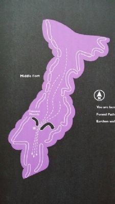
Crescent Mounds
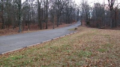
Early archaeologists once thought the Crescent Mounds served as the best fortified area of the site due to the shape of the walls. Today, they think this gateway served to funnel people through for ceremonial purposes, probably toward the Great Gateway, which is the entrance to the South Fort.
Erected by The Ohio Historical Society .
Topics. This historical marker is listed in these topic lists: Forts and Castles • Landmarks • Man-Made Features • Native Americans • Natural Features • Notable Places.
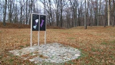
Location. 39° 24.129′ N, 84° 5.598′ W. Marker is near Morrow, Ohio, in Warren County. It is in Washington Township. Marker is in Fort Ancient State Memorial, near the parking lot in the Middle Fort, and about 0.4 mile SSW of the museum. Touch for map. Marker is at or near this postal address: 6123 Ohio Route 350, Oregonia OH 45054, United States of America. Touch for directions.
Other nearby markers. At least 8 other markers are within walking distance of this marker. Changes at Fort Ancient (approx. 0.2 miles away); The Great Gateway (approx. 0.2 miles away); Fort Ancient (approx. 0.2 miles away); The Civilian Conservation Corps (approx. 0.2 miles away); Fort Ancient Earthworks (approx. 0.2 miles away); Middle Fort Ditch Construction (approx. 0.2 miles away); Earthworks Trail (approx. ¼ mile away); The Myth of the Mound Builders (approx. ¼ mile away). Touch for a list and map of all markers in Morrow.
Also see . . .
1. Fort Ancient Earthworks. Ohio History Central website entry (Submitted on February 5, 2010, by William Fischer, Jr. of Scranton, Pennsylvania.)
2. Fort Ancient State Memorial
. Ohio State Parks website entry (Submitted on July 24, 2022, by Larry Gertner of New York, New York.)
Credits. This page was last revised on February 6, 2023. It was originally submitted on February 5, 2010, by William Fischer, Jr. of Scranton, Pennsylvania. This page has been viewed 740 times since then and 8 times this year. Photos: 1, 2, 3, 4, 5. submitted on February 5, 2010, by William Fischer, Jr. of Scranton, Pennsylvania.
