Fairfield in Fairfield County, Connecticut — The American Northeast (New England)
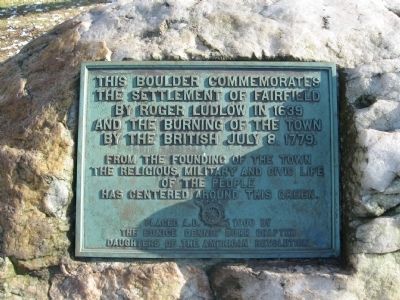
Fairfield Boulder
the settlement of Fairfield
by Roger Ludlow in 1639
and the burning of the Town
by the British July 8, 1779.
From the founding of the Town
the religious, military and civic life
of the people
has centered around this Green
Erected 1900 by the Eunice Dennie Burr Chapter, Daughters of the American Revolution.
Topics and series. This historical marker is listed in these topic lists: Colonial Era • Settlements & Settlers • War, US Revolutionary. In addition, it is included in the Daughters of the American Revolution series list. A significant historical date for this entry is July 8, 1921.
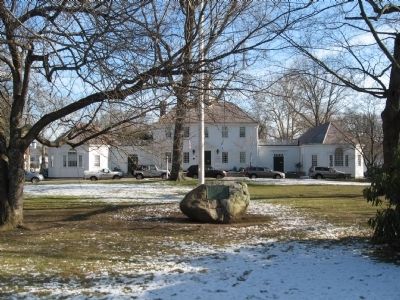
Location. 41° 8.571′ N, 73° 14.994′ W. Marker is in Fairfield, Connecticut, in Fairfield County. Marker is at the intersection of Old Post Road and Beach Road, on the left when traveling south on Old Post Road. Located on the green in front of Fairfield Town Hall known as Jennings Garden. Touch for map. Marker is in this post office area: Fairfield CT 06824, United States of America. Touch for directions.
Other nearby markers. At least 8 other markers are within walking distance of this marker. Fairfield Honor Roll (a few steps from this marker); Fairfield Vietnam War Memorial (a few steps from this marker); Remarkable Trees (within shouting distance of this marker); Is Fairfield the Seat of Fairfield County? (within shouting distance of this marker); Ronald Reagan Visit (within shouting distance of this marker); Readin’, Writin’, and ‘Rithmetic (about 300 feet away, measured in a direct line); Sun Tavern (about 300 feet away); Sun Tavern: Did George Washington Sleep Here? (about 400 feet away). Touch for a list and map of all markers in Fairfield.
Credits. This page was last revised on June 16, 2016. It was originally submitted on February 6, 2010, by Michael Herrick of Southbury, Connecticut. This page has been viewed 1,490 times since then and 18 times this year. Photos: 1, 2, 3, 4. submitted on February 6, 2010, by Michael Herrick of Southbury, Connecticut. • Kevin W. was the editor who published this page.


