Near Loyd in County Meath, Leinster, Ireland — Mid-East (and Dublin)
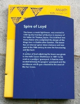
Spire of Loyd
Kells Heritage Trail
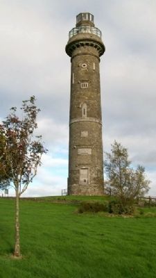
The tower, a mock lighthouse, was erected in 1791 by the First Earl of Bective in memory of his father Sir Thomas Taylor. The architect was Henry Baker who completed the design of the Kings Inns in Dublin after Gandon. The tower has an internal spiral stone staircase and was used in the 19th century to view the horseracing and the hunt.
A section of land adjoining the tower was given to the Kells Union Workhouse in 1851 to be used as a paupers' graveyard. A famine road existed between the paupers' graveyard and the workhouse which was situated to the west of the Fair Green.
Erected by Meath Tourism.
Topics. This historical marker is listed in these topic lists: Cemeteries & Burial Sites • Charity & Public Work • Man-Made Features • Settlements & Settlers. A significant historical year for this entry is 1791.
Location. 53° 43.988′ N, 6° 54.294′ W. Marker is near Loyd, Leinster, in County Meath. Marker is on the Spire base, on the Commons of Loyd off Oldcastle Road (Road R163), about 2.5 kilometers west of Kells. Touch for map. Touch for directions.
Other nearby markers. At least 8 other markers are within 3 kilometers of this marker, measured as the crow flies. Kells Union Workhouse Paupers' Graveyard (within shouting distance of this marker); Kells Round Tower (approx. 1.7 kilometers away); Catherine Dempsey (approx. 1.7 kilometers away); The Churchyard Wall (approx. 1.8 kilometers away); Suffolk Street (approx. 1.8 kilometers away); St Columba's Church (approx. 1.8 kilometers away); Headfort Place (approx. 2.3 kilometers away); Kells Courthouse (approx. 2.3 kilometers away).
Credits. This page was last revised on January 2, 2020. It was originally submitted on February 9, 2010, by William Fischer, Jr. of Scranton, Pennsylvania. This page has been viewed 1,177 times since then and 7 times this year. Photos: 1, 2. submitted on February 9, 2010.

