Cherry Grove Beach in Horry County, South Carolina — The American South (South Atlantic)
Sonny’s Pavilion
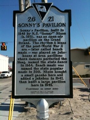
Sonny’s Pavilion, built in 1949 by N.F. “Sonny” Nixon, was an open-air pavilion on the Grand Strand. The rhythm & blues of the post-World War II era—later called beach music—was played on jukeboxes at area pavilions where dancers perfected the Shag, named the state dance in 1984. Beach music was named the state popular music in 2001. Nixon bought a small gazebo here and added a jukebox in 1947, then built a large pavilion here in 1949.
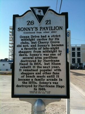
Ocean Drive had a strict midnight curfew for its clubs, but Cherry Grove did not, and Sonny’s became a favorite of late-night shaggers from midnight to dawn. Sonny’s was one of several area pavilions destroyed by Hurricane Hazel in 1954, but Nixon rebuilt it the next year. It remained popular with shaggers and other fans of beach music until it became a family arcade in the 1970s. Sonny’s was destroyed by Hurricane Hugo in 1989.
Erected 2009 by the O.D. Pavilion Social and Shag Club. (Marker Number 26-21.)
Topics. This historical marker is listed in these topic lists: Arts, Letters, Music • Entertainment. A significant historical year for this entry is 1949.
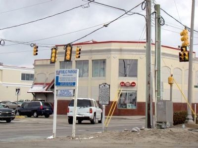
Location. 33° 49.667′ N, 78° 38.589′ W. Marker is in Cherry Grove Beach, South Carolina, in Horry County. Marker is at the intersection of North Ocean Boulevard (State Highway 65) and Sea Mountain Highway (State Highway 9), on the right when traveling north on North Ocean Boulevard. Touch for map. Marker is in this post office area: North Myrtle Beach SC 29582, United States of America. Touch for directions.
Other nearby markers. At least 8 other markers are within 6 miles of this marker, measured as the crow flies. Fort Randall (approx. 1.4 miles away); Roberts Pavilion / Ocean Drive Pavilion (approx. 1.8 miles away); Chestnut Consolidated School (approx. 2.7 miles away); Rebecca Randall Bryan (approx. 3.8 miles away); Rev. George Whitefield (approx. 3.8 miles away); Atlantic Beach (approx. 4.6 miles away); Boundary House (approx. 5.2 miles away); South Carolina / North Carolina (approx. 5˝ miles away in North Carolina).
Also see . . . Shag 101: A Lesson On Our Dance. Has A Dance PDF (Submitted on February 12, 2021, by Larry Gertner of New York, New York.)
Credits. This page was last revised on February 12, 2021. It was originally submitted on February 9, 2010, by David Bullard of Seneca, South Carolina. This page has been viewed 2,715 times since then and 78 times this year. Photos: 1, 2. submitted on February 9, 2010, by David Bullard of Seneca, South Carolina. 3. submitted on February 22, 2010, by J. J. Prats of Powell, Ohio. 4. submitted on February 9, 2010, by David Bullard of Seneca, South Carolina. • Craig Swain was the editor who published this page.


