Near Myrtle Beach in Horry County, South Carolina — The American South (South Atlantic)
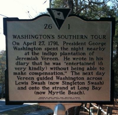
Washington's Southern Tour
Erected 2008 by Horry County, replacing a marker erected by the Horry County Historical Society in 1941. (Marker Number 26-1.)
Topics and series. This historical marker is listed in these topic lists: Patriots & Patriotism • Waterways & Vessels. In addition, it is included in the Former U.S. Presidents: #01 George Washington, and the George Washington Slept Here series lists. A significant historical month for this entry is April 1928.
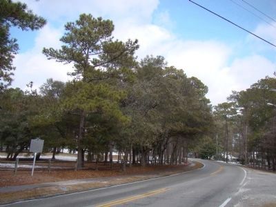
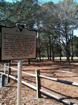
Location. 33° 46.722′ N, 78° 46.336′ W. Marker is near Myrtle Beach, South Carolina, in Horry County. Marker is on Kings Road, on the left when traveling north. Marker is located on the eastern side of Arcadian Shores Golf Club. Touch for map. Marker is in this post office area: Myrtle Beach SC 29572, United States of America. Touch for directions.
Other nearby markers. At least 8 other markers are within 9 miles of this marker, measured as the crow flies. Atlantic Beach (approx. 3.6 miles away); Roberts Pavilion / Ocean Drive Pavilion (approx. 6.4 miles away); Chestnut Consolidated School (approx. 7.4 miles away); Morris Island Lighthouse (approx. 7.4 miles away); Charlie's Place (approx. 7.9 miles away); Sonny’s Pavilion (approx. 8.2 miles away); Fort Randall (approx. 8.2 miles away); True Vine Missionary Baptist Church (approx. 8.3 miles away). Touch for a list and map of all markers in Myrtle Beach.
Credits. This page was last revised on December 14, 2019. It was originally submitted on February 9, 2010, by David Bullard of Seneca, South Carolina. This page has been viewed 5,191 times since then and 56 times this year. Photos: 1. submitted on February 9, 2010, by David Bullard of Seneca, South Carolina. 2. submitted on February 22, 2010, by J. J. Prats of Powell, Ohio. 3. submitted on February 9, 2010, by David Bullard of Seneca, South Carolina. • Bill Pfingsten was the editor who published this page.


