Hagood in Sumter County, South Carolina — The American South (South Atlantic)
Oakland Plantation
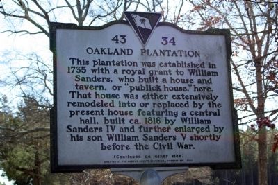
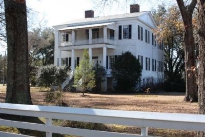
This plantation was established in 1735 with a royal grant to William Sanders, who built a house and tavern, or “publick house,” here. That house was either extensively remodeled into or replaced by the present house featuring a central hall, built ca. 1816 by William Sanders IV and further enlarged by his son William Sanders V shortly before the Civil War.
(Reverse text)
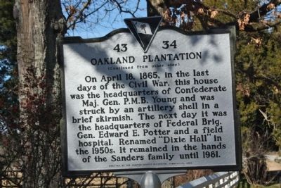
On April 18, 1865, in the last days of the Civil War, this house was the headquarters of Confederate Maj. Gen. P.M.B. Young and was struck by an artillery shell in a brief skirmish. The next day it was the headquarters of Federal Brig. Gen. Edward E. Potter and a field hospital. Renamed “Dixie Hall” in the 1950s, it remained in the hands of the Sanders family until 1981.
Erected 2002 by The Sumter County Historical Commission. (Marker Number 43-34.)
Topics. This historical marker is listed in these topic lists: Colonial Era • War, US Civil. A significant historical month for this entry is April 1917.
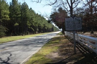
Location. 34° 3.91′ N, 80° 33.212′ W. Marker is in Hagood, South Carolina, in Sumter County. Marker is on Boykin Road (State Highway 261), on the right when traveling south. Located North of Mary Francis Lane. Touch for map . Marker is in this post office area: Rembert SC 29128, United States of America. Touch for directions.
Other nearby markers. At least 8 other markers are within 6 miles of this marker, measured as the crow flies. Skirmish at Dinkins' Mill (approx. 1.9 miles away); Lenoir Store (approx. 3.1 miles away); Burwell Boykin / Battle of Boykins Mill (approx. 4.8 miles away); Battle of Boykin's Mill (approx. 4.8 miles away); Site of Furman Academy (approx. 5.3 miles away); Furman Academy and Theological Institution (approx. 5.4 miles away); General Sumter Memorial Academy (approx. 5.6 miles away); General Thomas Sumter (approx. 5.6 miles away).
Credits. This page was last revised on June 16, 2016. It was originally submitted on February 13, 2010, by Mike Stroud of Bluffton, South Carolina. This page has been viewed 3,455 times since then and 175 times this year. Photos: 1, 2, 3, 4, 5. submitted on February 13, 2010, by Mike Stroud of Bluffton, South Carolina. • Craig Swain was the editor who published this page.


