Liberty Hill in Kershaw County, South Carolina — The American South (South Atlantic)
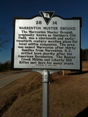
Warrenton Muster Ground
The Warrenton Muster Ground, originally known as Gardner's Old Field, was a nineteenth and early-twentieth century meeting place for local militia companies. The area was named Warrenton after thirty families from Warrenton, N.C. settled here shortly after the American Revolution. The Beaver Creek Militia and Liberty Hill Rifles met here for many years.
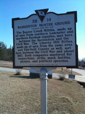
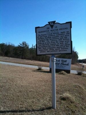
The Beaver Creek Militia, made up of men from southern Lancaster and northern Kershaw counties, met here between the Revolution and the Civil War. The Liberty Hill Rifles, made up of men from the same area and Fairfield County as well, met here between the Civil War and about 1910. Both companies mustered for inspections, drills, mock battles, picnics, and political speeches.
Erected 2005 by the Kershaw County Historical Society. (Marker Number 28-14.)
Topics. This historical marker is listed in these topic lists: Military • War, US Civil • War, US Revolutionary. A significant historical year for this entry is 1910.
Location. 34° 31.22′ N, 80° 46.279′ W. Marker is in Liberty Hill, South Carolina, in Kershaw County. Marker is on State Highway 522, on the right when traveling north. Marker is about 4 miles north of Liberty Hill or 0.2 miles south of the county line. Touch for map . Marker is in this post office area: Liberty Hill SC 29074, United States of America. Touch for directions.
Other nearby markers. At least 8 other markers are within 8 miles of this marker, measured as the crow flies. Stoneboro (approx. 2.4 miles away); Peay's Ferry / Peay's Ferry Road (approx. 3.8 miles away); Mt. Carmel Campground (approx. 5.3 miles away); Birthplace of James Marion Sims, M.D. (approx. 6.3 miles away); James Ingram Home (approx. 6˝ miles away); Rocky Mount (approx. 6.7 miles away); The Battle Of The Hanging Rock (approx. 7 miles away); Beaver Creek Skirmish / Capture of Provisions at Flat Rock (approx. 7.2 miles away).
Credits. This page was last revised on January 1, 2021. It was originally submitted on February 18, 2010, by David Bullard of Seneca, South Carolina. This page has been viewed 1,505 times since then and 28 times this year. Photos: 1, 2, 3. submitted on February 18, 2010, by David Bullard of Seneca, South Carolina. • Craig Swain was the editor who published this page.


