Central City in Phoenix in Maricopa County, Arizona — The American Mountains (Southwest)
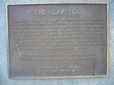
The Capitol
Erected 1969 by Woodmen of the World Jurisdiction of Arizona.
Topics. This historical marker is listed in this topic list: Government & Politics. A significant historical year for this entry is 1900.
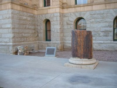
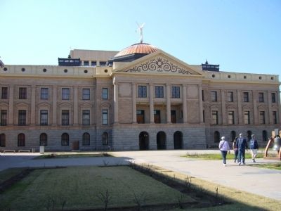
Location. 33° 26.895′ N, 112° 5.809′ W. Marker is in Phoenix, Arizona, in Maricopa County. It is in Central City. Marker can be reached from West Adams Street. Parking available at Bolin Memorial Park. Then walk to all the markers and monuments in this vicinity. Enter park from east-bound Jefferson Street or west-bound Washington Street, just east of 17th Avenue. Marker is located at the front of the Arizona State Capitol Building. Touch for map. Marker is at or near this postal address: 1740 West Adams Street, Phoenix AZ 85007, United States of America. Touch for directions.
Other nearby markers. At least 8 other markers are within walking distance of this marker. Arizona's War Heroes (here, next to this marker); Arizona’s Liberty Bell Monument (within shouting distance of this marker); Lt. Frank Luke, Jr. (within shouting distance of this marker); Eusebio Francisco Kino (about 500 feet away, measured in a direct line); Arizona's Pioneer Women (about 500 feet away); Navajo Code Talkers (about 500 feet away); Jewish War Veterans Memorial (about 700 feet away); Vietnam Veterans Memorial (about 700 feet away). Touch for a list and map of all markers in Phoenix.
Also see . . . Arizona State Capitol. Wikipedia article on the Arizona State Capitol building in Phoenix. It formerly housed the Territorial and State Legislatures, as well as various executive offices. These have relocated to adjacent buildings, and the Capitol is now maintained as the Arizona Capitol Museum. (Submitted on February 18, 2010, by Bill Kirchner of Tucson, Arizona.)
Credits. This page was last revised on February 2, 2023. It was originally submitted on February 18, 2010, by Bill Kirchner of Tucson, Arizona. This page has been viewed 1,167 times since then and 30 times this year. Photos: 1, 2, 3. submitted on February 18, 2010, by Bill Kirchner of Tucson, Arizona. • Syd Whittle was the editor who published this page.


