Burnet in Burnet County, Texas — The American South (West South Central)
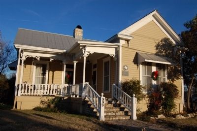
The Russell-McFarland Homestead
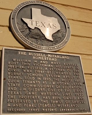
William H. and Mary Russell built this Victorian residence in 1883-84. Russell, a veteran of the Civil War (1861-65), headed the Burnet school system about 15 years. Sold in 1895, the house had such tenants as J. W. Edgar, later state commissioner of education, and J. H. Gildart, one of the first Texas game wardens. Since 1922 the property has been owned and preserved by the family of Samuel A. and Pearl (Teagle) McFarland.
Recorded Texas Historic Landmark - 1978
Erected 1978 by Texas Historical Commission. (Marker Number 9746.)
Topics. This historical marker is listed in this topic list: Notable Buildings. A significant historical year for this entry is 1895.
Location. 30° 45.691′ N, 98° 13.504′ W. Marker is in Burnet, Texas, in Burnet County. Marker is at the intersection of N. Boundry St. and E. Johnson St., on the right when traveling north on N. Boundry St.. Touch for map. Marker is at or near this postal address: 309 N Boundary St, Burnet TX 78611, United States of America. Touch for directions.
Other nearby markers. At least 8 other markers are within walking distance of this marker. Red Brick School (about 700 feet away, measured in a direct line); Old Cook Home (approx. ¼ mile away); Burnet County Jail (approx. ¼ mile away); Burnet County (approx. 0.3 miles away); a different marker also named Burnet County (approx. 0.3 miles away); The Badger Building (approx. 0.3 miles away); General Adam R. Johnson (approx. 0.3 miles away); The Burnet Bulletin (approx. 0.4 miles away). Touch for a list and map of all markers in Burnet.
Credits. This page was last revised on November 25, 2020. It was originally submitted on February 18, 2010, by Keith Peterson of Cedar Park, Texas. This page has been viewed 996 times since then and 23 times this year. Photos: 1, 2. submitted on February 18, 2010, by Keith Peterson of Cedar Park, Texas. • Bill Pfingsten was the editor who published this page.

