Near Bertram in Burnet County, Texas — The American South (West South Central)
Shady Grove Community
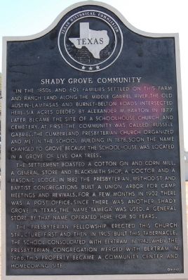
In the 1850s and 60s families settled on this farm and ranch land along the Middle Gabriel river. The Old Austin-Lampasas and Burnet-Belton roads intersected here. Six acres deeded by Alexander M. Barton in 1877 later became the site of a schoolhouse, church and cemetery. At first the community was called "Russell Gabriel". The Cumberland Presbyterian Church organized and met in the school building in 1878. Soon the name changed to "Grove" because the schoolhouse was located in a grove of live oak trees.
The settlement boasted a cotton gin and corn mill, a general store and blacksmith shop, a doctor and a Masonic Lodge. In 1882 the Presbyterian, Methodist and Baptist congregations built a Union Arbor for camp meetings and revivals. For a few months in 1902 there was a post office. Since there was another Shady Grove in Texas, the name "Tamega" was used. A general store by that name operated here for 50 years.
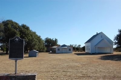
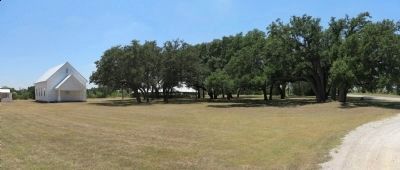
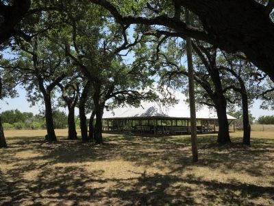
The Presbyterian fellowship erected this church structure first and then in 1905 built this tabernacle. The school consolidated with Bertram in 1942. When the Presbyterian congregation merged with Bertram in 1966, this property became a community center and homecoming site.
Erected 1979 by Texas Historical Commission. (Marker Number 9747.)
Topics. This historical marker is listed in this topic list: Settlements & Settlers. A significant historical year for this entry is 1877.
Location. 30° 49.028′ N, 98° 5.009′ W. Marker is near Bertram, Texas, in Burnet County. Marker is on CR-200, 0.1 miles west of FM-1174, on the right when traveling east. Touch for map. Marker is in this post office area: Bertram TX 78605, United States of America. Touch for directions.
Other nearby markers. At least 8 other markers are within 6 miles of this marker, measured as the crow flies. Site of Town of Strickling (approx. 2.1 miles away); Black's Fort (approx. 2.3 miles away); Joppa Community (approx. 3.1 miles away); Russell Fork Iron Truss Bridge (approx. 3.4 miles away); Joppa Iron Truss Bridge (approx. 3.4 miles away); Bertram (approx. 5 miles away); Bertram School (approx. 5.2 miles away); The City of Bertram (approx. 5.3 miles away). Touch for a list and map of all markers in Bertram.
Credits. This page was last revised on November 24, 2020. It was originally submitted on February 18, 2010, by Keith Peterson of Cedar Park, Texas. This page has been viewed 999 times since then and 35 times this year. Photos: 1, 2. submitted on February 18, 2010, by Keith Peterson of Cedar Park, Texas. 3, 4. submitted on July 26, 2015, by Richard Denney of Austin, Texas. • Bill Pfingsten was the editor who published this page.


