Brentsville in Prince William County, Virginia — The American South (Mid-Atlantic)
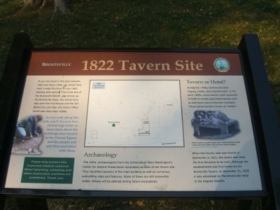
1822 Tavern Site
Brentsville
As you walk along this path, you’ll discover how archaeology helps us learn more about the buildings once located in the Tavern Square and the people and activities associated with them.
(sidebar) Please help us protect this important historic resource. Metal detecting, collecting and other destructive activities are prohibited. Thank you.
Archaeology
The 2004, archaeologists from the University of Mary Washington’s Center for Historic Preservation excavated portions of the Tavern site. They identified sections of the main building as well as numerous outbuilding sites and features. Some of these are still somewhat visible. Others will be defined during future excavations.
Tavern or Hotel?
During the 1700s, taverns provided lodging, meals, and entertainment. In the early 1800s, some taverns were expanded or built to include specialized spaces such as ballrooms and private bed chambers. These places became known as “hotels”.
(caption under upper, right picture) Tavern guests usually shared beds. Hotels offered private rooms and were better able to serve female lodgers.
Courtesy of the Library of Congress
When the County seat was moved to Brentsville in 1822, this tavern was likely the first structure to be built. Although the establishment was first known as the Brentsville Tavern, on November 22, 1828 it was advertised as The Brentsville Hotel in the Virginia Gazette.
Erected 2007 by Prince William County and the Friends of Brentsville Courthouse Historic Centre.
Topics. This historical marker is listed in these topic lists: Colonial Era • Settlements & Settlers. A significant historical month for this entry is November 1672.
Location. 38° 41.392′ N, 77° 30.079′ W. Marker is in Brentsville, Virginia, in Prince William County. Marker is on Bristow Road (County Route 619), on the right when traveling west. Touch for map. Marker is at or near this postal address: 12235 Bristow Road, Bristow VA 20136, United States of America. Touch for directions.
Other nearby markers. At least 8 other markers are within walking distance of this marker. Union Church (a few steps from this marker); Tavern Lot (a few steps from this marker); Tavern Archaeology (a few steps from this marker); Tavern (a few steps from this marker); Outbuildings

Photographed By Kevin W., September 26, 2007
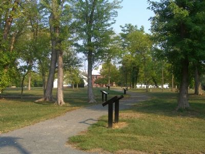
2. A path full of markers. The 1822 Tavern Site Marker is the second in line.
As you walk along this path, you’ll discover how archaeology helps us learn more about the buildings once located in the Tavern Square and the people and activities associated with them.
More about this marker. The markers shown in picture 2 were installed in the Brenstville Courthouse Historic Centre in May 2007. The 1822 Tavern Site marker is between Union Church and the One-Room School.
Credits. This page was last revised on July 8, 2020. It was originally submitted on October 1, 2007, by Kevin W. of Stafford, Virginia. This page has been viewed 1,346 times since then and 9 times this year. Photos: 1, 2. submitted on October 1, 2007, by Kevin W. of Stafford, Virginia.
