Cypress in Suffolk, Virginia — The American South (Mid-Atlantic)
Nansemond County / Norfolk County
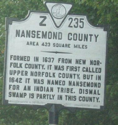
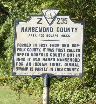
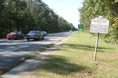
Nansemond County. Area 423 Square Miles. Formed in 1637 from New Norfolk County, it was first called Upper Norfolk County, but in 1642 it was named Nansemond for an Indian tribe. Dismal Swamp is partly in this county.
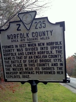
Norfolk County. Area 415 Square Miles. Formed in 1637, when New Norfolk County was divided into Upper Norfolk and Lower Norfolk. The name is that of an English County. The Battle of Great Bridge, 1775, took place in this county, and in the waters near its shores the warship Merrimac performed her exploits, 1862.
Erected 1931 by Conservation and Development Commission. (Marker Number Z-235.)
Topics and series. This historical marker is listed in these topic lists: Native Americans • Political Subdivisions. In addition, it is included in the Virginia Department of Historic Resources (DHR) series list. A significant historical year for this entry is 1637.
Location. Marker is missing. It was located near 36° 46.253′ N, 76° 27.824′ W. Marker was in Suffolk, Virginia. It was in Cypress. Marker was on U.S. 58 (U.S. 460) west of the Hampton Roads Airport, on the right when traveling south. This marker could be seen on the highway just as you cross into Suffolk from Chesapeake. Located west of Hampton Roads Executive Airport between I 664 and Nansemond Parkway. Touch for map. Marker was in this post office area: Chesapeake VA 23321, United States of America. Touch for directions.
Other nearby markers. At least 8 other markers are within 4 miles of this location, measured as the crow flies. Pig Point Battery (approx. 0.3 miles away); Sunray (approx. 3 miles away); Site of the Nansemond Indian Public School #9 (approx. 3.6 miles away); Revolutionary Camp (approx. 3.6 miles away); Florence Graded School (approx. 4 miles away); James Bowser, Revolutionary Soldier (approx. 4 miles away); Glebe Church (approx. 4.1 miles away); Hargrove's Tavern (approx. 4.1 miles away). Touch for a list and map of all markers in Suffolk.
More about this marker. This marker is at the northern end of the Great Dismal Swamp.
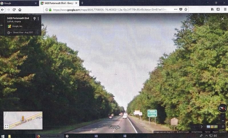
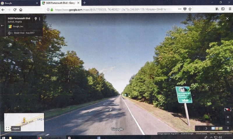
Revision, June 6, 2018: As of a May 25, 2018 observation, marker number Z-235 Nansemond County/Norfolk County is missing. It was removed at some point between August 2017 (see Exhibit B) and the observation date. Evidently the marker was replaced with a different type of highway sign (see Exhibit A).
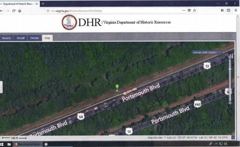
The Virginia Department of Historic Resources (DHR) could not attest to the marker’s reported status because its database indicated that Z-235 is still standing (see Exhibit E).
This marker, based on its number
prefix of letter “Z”, was a jurisdictional one. All similar markers, according to DHR’s website, have a different inscription on each side. Typically placed at a county or state line, one side provides information about the jurisdiction being entered and the reverse tells about the one being left.
Although Z-235 held historical significance, the two counties described by it are now extinct. See the “Regarding Nansemond County/Norfolk County” section for when and why. The names of these counties are preserved, however, by other means, such as the Nansemond River, Nansemond Indians, and Norfolk County Historical Society of Chesapeake.
The “Editor’s Want List” for Z-235 had included a request for the marker’s exact GPS coordinates and clarification of its jurisdiction. See Exhibit E for GPS data from the DHR’s aerial shot and Exhibit A for proof that it did stand within the boundary sign for the City of Suffolk.
An unthinkable thought emerges in this photo gallery of marker number Z-235 Nansemond County/Norfolk County. Would one dare ask, “Was the Suffolk city limit sign moved also?” (by Cynthia L. Clark)
Regarding Nansemond County / Norfolk County. Nansemond County is an extinct Virginia county. The county became the independent city of Nansemond in July 1972 and in 1974 merged with the city of Suffolk. Suffolk was incorporated as a town in 1808, and as a city in 1910.
Norfolk County is also an extinct Virginia county. After the Civil War, portions of Norfolk County were lost as they became part of the separate independent cities of Norfolk, Portsmouth, and the former city of South Norfolk. In 1963 the remaining portions were consolidated with the city of South Norfolk to form the City of Chesapeake.
Related marker. Click here for another marker that is related to this marker.
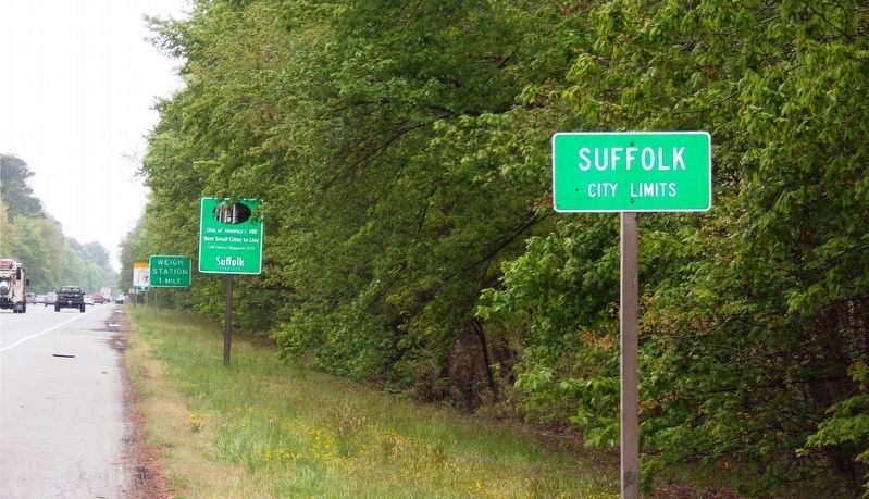
Photographed By Cynthia L. Clark, April 25, 2018
6. Exhibit A: Z-235 is Missing.
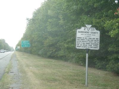
The viewer’s focal point is the sign (far background) that reads: “Weigh Station 1 Mile.” Marker number Z-235 once stood in front of it. See the photos by Laura Troy (October 1, 2007) and Mike Stroud (October 15, 2011) as well as Exhibit B. Currently standing in that position is a sign that reads: “One of America’s 100 best small cities to live. CNN Money Magazine 2010. Suffolk, Virginia.”
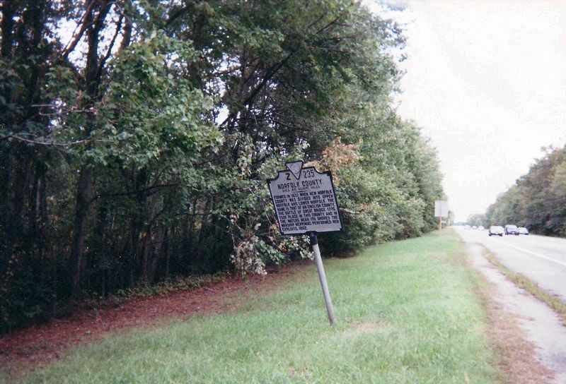
Photographed By Cynthia L. Clark, March 25, 2011
8. Exhibit C: Z-235 Nansemond County/Norfolk County Marker
Here the viewer is looking in a northeast angle along Portsmouth Boulevard (US 13/US 58) in Suffolk. Pictured in the far center background is the backside of a sign with a front that reads: “One of America’s 100 best small cities to live. CNN Money Magazine 2010. Suffolk, Virginia.” This sign now stands where Z-235 once stood.
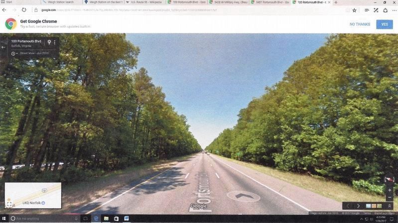
Courtesy of Google Earth Map, 2016.
11. Exhibit F – June 2016 Signs Positions.
This Google map image was captured January 20, 2017. And despite its poor quality, four roadside signs, distinguishable by color and shape, are visible. Here marker Z-235 appears as a small white speck near the last car on the highway. It stands between the Suffolk promotional (second) and weigh station (last) signs. Compare with ( Exhibit D ). The Suffolk’s city limit sign is pictured first.
Credits. This page was last revised on February 1, 2023. It was originally submitted on October 2, 2007, by Laura Troy of Burke, Virginia. This page has been viewed 1,795 times since then and 33 times this year. Last updated on June 14, 2018, by Cynthia L. Clark of Suffolk, Virginia. Photos: 1. submitted on October 2, 2007, by Laura Troy of Burke, Virginia. 2. submitted on March 24, 2011, by James Thomson of Chesapeake, United States. 3. submitted on October 2, 2007, by Laura Troy of Burke, Virginia. 4, 5. submitted on October 29, 2011, by Mike Stroud of Bluffton, South Carolina. 6, 7, 8. submitted on June 6, 2018, by Cynthia L. Clark of Suffolk, Virginia. 9, 10, 11. submitted on June 10, 2018, by Cynthia L. Clark of Suffolk, Virginia. • Andrew Ruppenstein was the editor who published this page.
